Catalog Archive
Auction 125, Lot 382

"Barbadoes, Surveyed by William Mayo, Engraved and Improved by Thomas Jefferys…", Jefferys, Thomas
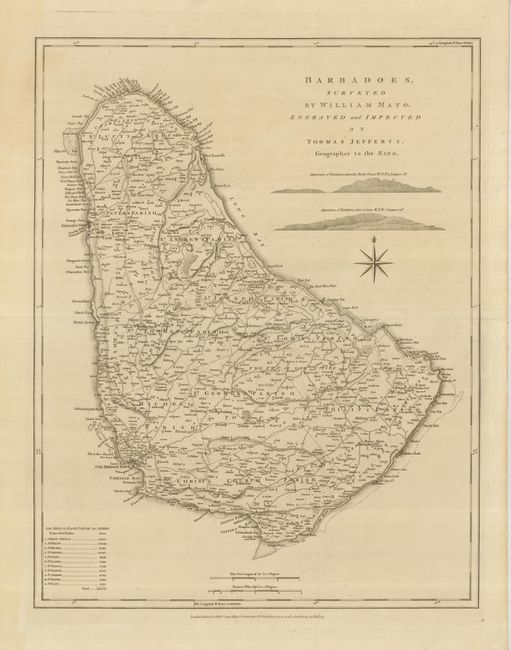
Subject: Barbados

Period: 1775 (dated)

Publication: West India Atlas

Color: Black & White

Size:
18.5 x 24 inches
47 x 61 cm
Download High Resolution Image
(or just click on image to launch the Zoom viewer)

This large-scale map is based on William Mayo's important survey of the island. Mayo's was the second systematic, and first large-scale survey and it fixed the legal bounds of the parishes. It was not until the Admiralty survey of 1873 that Mayo's map ceased to be the standard representation for maps of Barbados. The map shows the eleven parishes with their areas listed in a key below. It depicts the ports, settlements, forts, churches, roads, and sugar plantations with landowners' names. Relief is shown by hachures and two finely drawn landfall approach views for mariners are engraved between the title and compass rose. This is the first state with Robert Sayer's imprint in the bottom margin.

References: Campbell (MCC-21) #38.

Condition: A+

Fine impression and wide original margins.

Estimate: $700 - $800

Sold for: $500

Closed on 9/24/2008

Archived