Catalog Archive
Auction 125, Lot 364
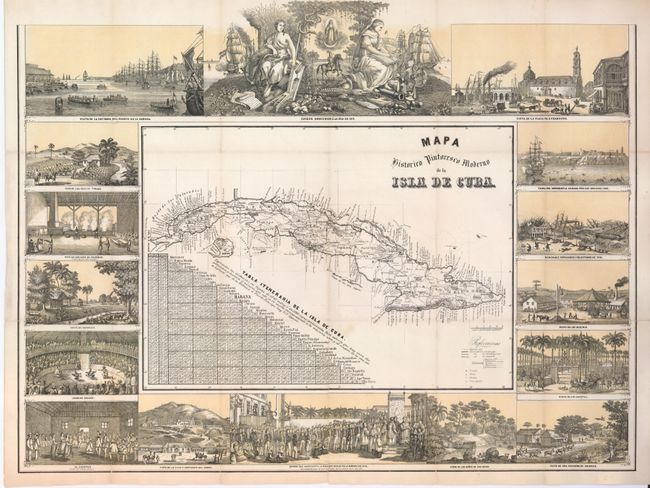
"Mapa Historico Pintoresco Moderno de la Isla de Cuba", May, Bernardo
Subject: Cuba
Period: 1853 (published)
Publication: Album Pintoresco de la isla de Cuba
Color: Printed Color
Size:
22.8 x 16.5 inches
57.9 x 41.9 cm
Download High Resolution Image
(or just click on image to launch the Zoom viewer)
(or just click on image to launch the Zoom viewer)