Catalog Archive
Auction 125, Lot 345

"Culiacanae, Americae Regionis Descriptio [on sheet with] Hispanoliae, Cubae, Aliarumque Insularum Circumiacientium, Delineato", Ortelius, Abraham

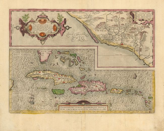
Subject: Mexico and the Caribbean

Period: 1595 (circa)

Publication: Theatrum Orbis Terrarum

Color: Hand Color

Size:
19.5 x 14 inches
49.5 x 35.6 cm
Download High Resolution Image
(or just click on image to launch the Zoom viewer)

Two great early maps of important regions in the New World are featured on this folio sheet. The first covers the region of western Mexico around Culiacan and the Spanish settlement of Villa S. Michael's, the region noted for its silver mines. The second is the first detailed map of the Greater Antilles with detail in southern Florida and the Caribbean that is quite remarkable for the period. This is the second state with the corrected Tropic of Cancer. Ortelius based the maps on a variety of sources including Mercator’s world map (1569) and other maps by Guttierez and Alonso de Santa Cruz. Three strapwork cartouches and sailing ships decorate the sheet. Latin text on verso.

References: Van den Broecke #14.

Condition: B+

Original color and margins. Centerfold split in bottom margin, repaired with paper on verso. Brown paper mounting tape remnants on verso. Marginal soiling and a couple unobtrusive spots.

Estimate: $1,200 - $1,400

Sold for: $700

Closed on 9/24/2008

Archived