Catalog Archive
Auction 125, Lot 291

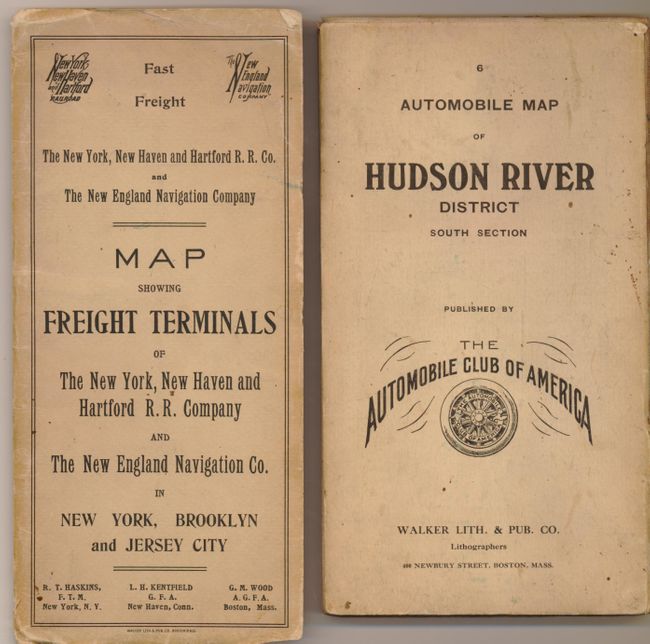
"[Lot of 2] Freight Terminals of the New York, New Haven and Hartford Railroad Co…. In New York, Brooklyn & Jersey City [and] Automobile Map of Hudson River District South No. 8", Walker, George H. & Co.

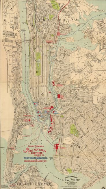
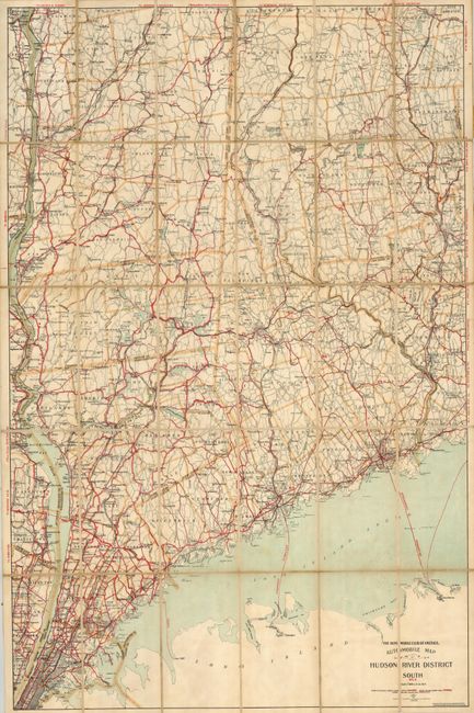
Subject: New York and New England

Period: 1907-1908 (dated)

Publication:

Color: Printed Color

Size:
See Description
Download High Resolution Image
(or just click on image to launch the Zoom viewer)

The first is a very detailed pocket map of New York City (22.8 x 40"), which focuses on the freight terminals, all shown in red overprinting and named. This large map includes Brooklyn, the Bronx, much of Newark and part of Staten Island. Colored lines delineate the routes for the New England Navigation Company, and the New York, New Haven & Hartford Railroad Company. The map shows the limit of New York's Lighterage. Lighterage is the charge for unloading freight from ships; in New York the service was free. This caused a contentious controversy with other ports such as Boston, Baltimore, and Philadelphia, who complained this unfair practice was used to attract more shipping to New York. Map folds into stiff paper covers (4" x 9"), shows ferry and railroad routes. Map is very good, covers with a little soiling. (B+)

The second is an early road map from the Automobile Club of America that includes most of Manhattan as well as western Connecticut and southeastern New York. Legend identifies Good Routes, State Roads, and Other Routes. Segmented and backed with linen, as issued, the map (27 x 40") self folds into printed outer covers (4.8 x 8.5"). Map has a little foxing in lower portion. Covers with light soiling. (B+)

References:

Condition:

See individual descriptions.

Estimate: $160 - $200

Sold for: $120

Closed on 9/24/2008

Archived