Catalog Archive
Auction 125, Lot 270

"[Lot of 3] Preliminary Coast Charts Nos. 12, 13 & 14 Monomoy and Nantucket Shoals to Block Island", U.S. Coast Survey

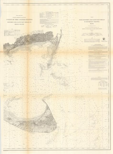
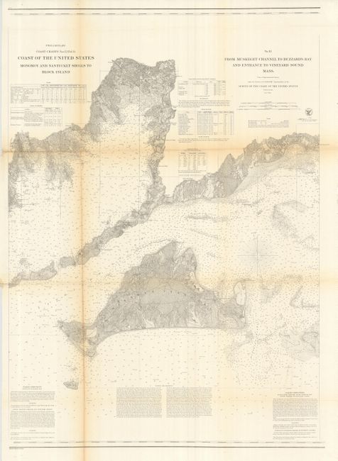
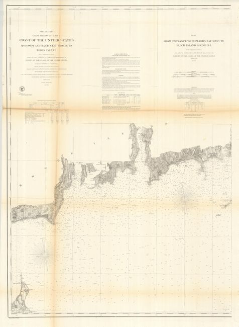
Subject: Massachusetts

Period: 1874 (published)

Publication:

Color: Black & White

Size:
28.5 x 37.5 inches
72.4 x 95.3 cm
Download High Resolution Image
(or just click on image to launch the Zoom viewer)

This matched set of charts provides a detailed examination of the Northeast Atlantic in the vicinity of Nantucket and Martha's Vineyard. These navigational aids are filled with sailing directions, dangers in the area, and information on tides, winds, currents, etc. Size given is approximate for each chart. Set includes: No. 12 - From Monomoy and Nantucket Shoals to Muskegee Channel Mass.; No. 13 - From Muskeget Channel to Buzzard's Bay and Entrance to Vineyard Sound Mass.; No. 14 - From Entrance to Buzzard's Bay Mass. To Block Island South RI.

References:

Condition: B

Issued folding, now backed with archival tissue to stabilize fold weakness. All very good except for heavy toning and paper weakness along upper horizontal fold.

Estimate: $400 - $600

Sold for: $300

Closed on 9/24/2008

Archived