Catalog Archive
Auction 125, Lot 221

"Johnson's California Territories of New Mexico and Utah", Johnson & Browning

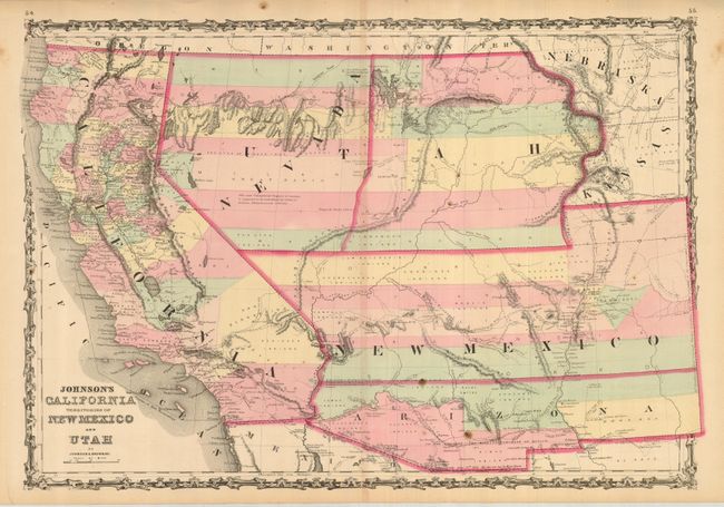
Subject: Southwestern United States

Period: 1861 (circa)

Publication: Illustrated Family Atlas of the World

Color: Hand Color

Size:
24.5 x 17 inches
62.2 x 43.2 cm
Download High Resolution Image
(or just click on image to launch the Zoom viewer)

Early map from Johnson's Southwest series. Arizona appears in the southern third of New Mexico Territory. The map names the "Gadsden Ten Million Purchase of Mexico" line. Nevada Territory makes an early appearance; its boundary with Utah begins on the western shore of the Great Salt Lake, wandering south-southwest from Lake Sevier. Hastily added to this plate, 'Nevada' is crudely fitted in an arc between the U and T of Utah. Filled with interesting notations, one observation near Quartzite, Arizona refers to the area as being "fertile and abundantly timbered and well watered," which it most certainly is not. The Emigrant Road, the Hastings Road, and the routes of numerous explorers and military expeditions are detailed. The Gold Region of present-day Colorado's South Park is prominently shown in what was then Kansas. A superb and desirable map of the Southwest.

References: Wheat [TMW] #1027.

Condition: B+

Fine original hand coloring and full margins. This bright example has a short centerfold split at bottom, a trace of centerfold toning, and two spots in Arizona, else a very good example that shows well.

Estimate: $300 - $400

Sold for: $210

Closed on 9/24/2008

Archived