Catalog Archive
Auction 125, Lot 214

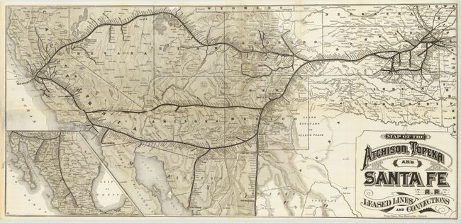
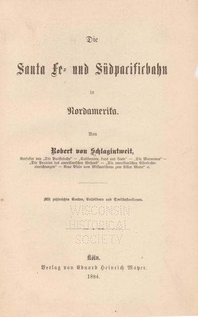
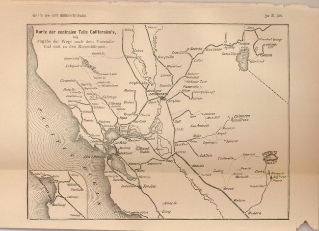
"Map of the Atchison, Topeka and Santa Fe R.R. Leased Lines and Connections [with] Die Santa Fe und Sudpacificbohn in Nordamerika", Poole Bros.

Subject: Western United States, Railroads

Period: 1884 (published)

Publication:

Color: Black & White

Size:
33 x 15.7 inches
83.8 x 39.9 cm
Download High Resolution Image
(or just click on image to launch the Zoom viewer)

This great railroad map is from a rare German tour book by Robert von Schlagintweit, who wrote several books on the American West. The text includes an extensive description of the Southwest including sections on the Grand Canyon, Los Angeles, the Cliff House in San Francisco, Yosemite, military forts, Las Vegas, Dodge City, and mining districts including Leadville and Central City. There is also information on famous outlaws such as the James brothers and Billy the Kid. The large folding map by Poole Brothers of Chicago shows the lines of the railroad from Kansas and Missouri west to California and into Mexico. The book is illustrated with 29 woodcut plates of scenery along the route, three of which are small maps of the train route. Book measures 8.25 x 5.5" and includes the original marbled boards; disbound, but complete. Book was withdrawn from the University of Wisconsin Library.

References:

Condition: C

Map is fully split at the horizontal fold, and has a small amount of loss along the split. Book is disbound with no spine. The relatively easy conservation would be well worth the effort.

Estimate: $300 - $500

Sold for: $200

Closed on 9/24/2008

Archived