Catalog Archive
Auction 125, Lot 206

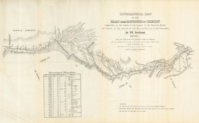
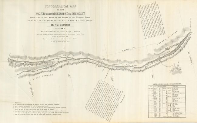
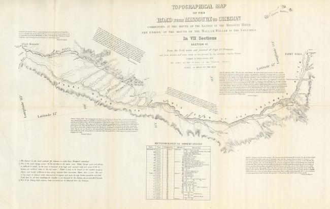
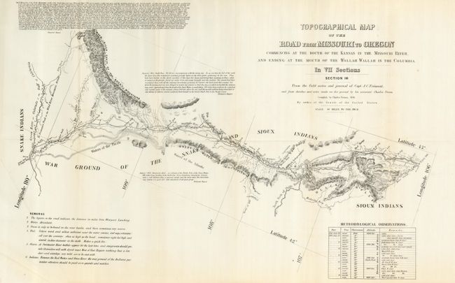
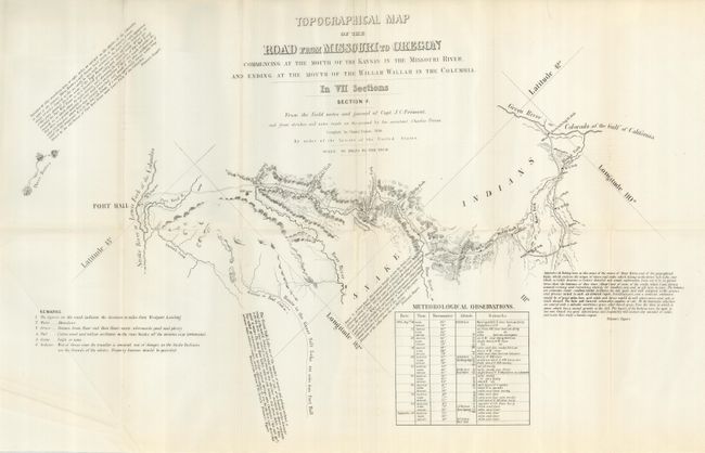
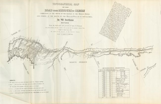
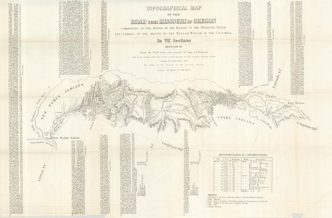
"[Lot of 7] Topographical Map of the Road from Missouri to Oregon in Seven Sections", Fremont/Preuss

Subject: Western United States

Period: 1849 (published)

Publication:

Color: Black & White

Size:
26 x 16 inches
66 x 40.6 cm
Download High Resolution Image
(or just click on image to launch the Zoom viewer)

This historic set of maps was compiled by Charles Preuss during Fremont's controversial Third Expedition. Preuss created this rare seven-part map from Fremont's map of 1845 with additional topography not included on the parent map. He used Fremont's sketches and notes as well as his own expedition notes. Wheat calls this set of maps a rarity that is important in the "evolution of the transcontinental wagon roads" and deserves "close study." Wheat devotes four pages to describe the maps and illustrates all seven in his monumental work. The map was published as a public document by order of the Senate. Each map is approximately the size given. Together the seven cover the region "commencing at the Mouth of the Kansas in the Missouri River, and Ending at the Mouth of the Wallah Wallah in the Columbia" - thus the Oregon Trail Route. Each sheet contains fascinating comments from Fremont's narrative, and notes regarding water, grass, fuel, game and Indians; invaluable information for emigrants at the time. An exceptional set of the second state of these rare and historically important maps.

References: Wheat (TMW) #523.

Condition: A+

Folding as issued and all with binding stitching holes at binding trim side.

Estimate: $2,500 - $3,500

Sold for: $2,750

Closed on 9/24/2008

Archived