Catalog Archive
Auction 125, Lot 160

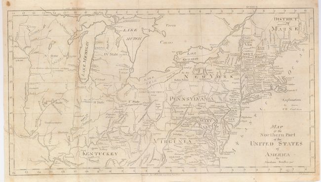
"Map of the Northern Part of the United States of America", Bradley, Abraham Jr.

Subject: Eastern United States

Period: 1797 (published)

Publication: Morse's American Gazetteer

Color: Black & White

Size:
15.8 x 8.5 inches
40.1 x 21.6 cm
Download High Resolution Image
(or just click on image to launch the Zoom viewer)

This map of the young United States presents early knowledge of topography and watershed, roads and settlements. The map covers the region from the District of Maine south to Virginia and Kentuckey, and westward to just beyond the Mississippi River. West of the Mississippi lands are "Reserved by the U.S." In the western frontier are Large Meadows…, Coal Mines, and Very Large Meadows. St. Louis is located by a tiny dot. A Great Cave is located just west of Kentucky near the Ohio River. Lines show the "Indian Boundary" and "Gen. Wayne's Treaty 1795" line. Beyond this line numerous reservations are located including Chicago. The Western Reserve is here called New Connecticut. Five proposed new states are indicated with Roman numerals, which match closely Wisconsin, Michigan, Illinois, Indiana and Ohio. This is the first edition of Bradley's map.

References: Wheat & Brun #158.

Condition: B+

Issued folding. A few light spots, two tiny fold intersection splits, short tear in left margin from binding fold, closed on verso, and a short marginal fold split in lower margin.

Estimate: $220 - $275

Sold for: $160

Closed on 9/24/2008

Archived