Catalog Archive
Auction 125, Lot 137

"[Lot of 4 - Alaska, Western Canada]", Various

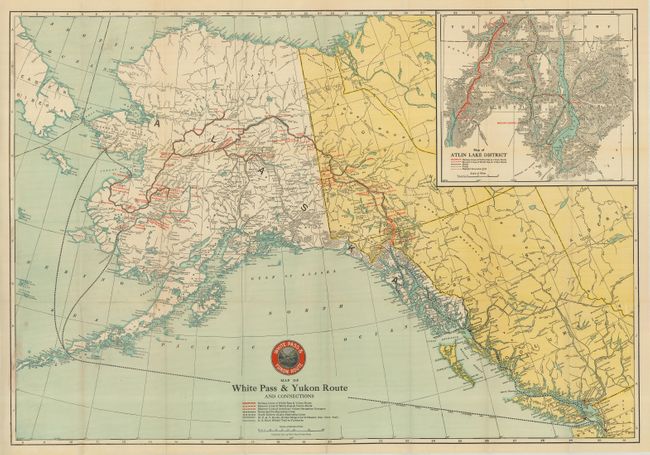
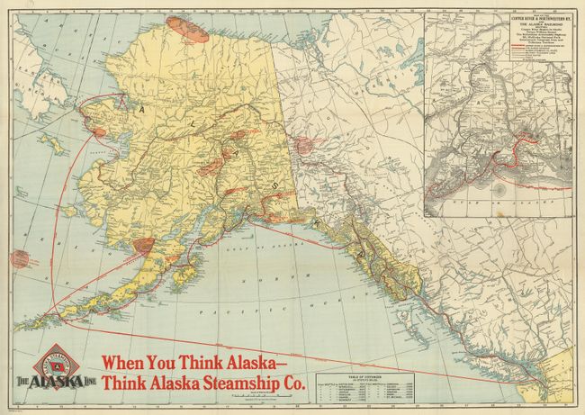
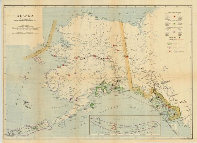
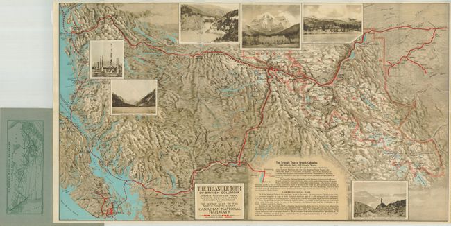
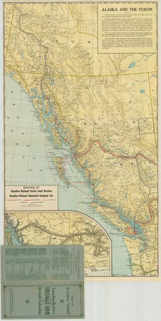
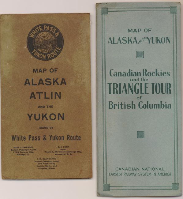
Subject: Alaska & Western Canada

Period: 1915-17

Publication:

Color: Printed Color

Size:
See Description
Download High Resolution Image
(or just click on image to launch the Zoom viewer)

1) Map of White Pass & Yukon Route and Connections, 1917, (30 x 20.8"). This folding pocket map is very finely printed. The routes of the White Pass & Yukon railways and steamers are shown with red overprinting. Also shows the routes of the Nome-Seattle Steamship Lines, South Eastern Alaska Steamship Lines, the W.P. & U. Stage line to Dawson (Canadian Government Trail), and the U.S. Government winter trail to Fairbanks. Large inset "Map of Atlin Lake District" shows the region in great detail on a scale of 10 miles per inch. Map folds into brown printed wrappers (4.3 x 7.7"). Very good, map loose from covers.

2) Untitled, Chicago, Poole Bros., 1917, (30.4 x21.5"). Inset "Map of the Copper River & Northwestern Ry. And the Alaska Railroad." Published for the Alaska Steamship Company with its colorful logo at lower left. Bold red overprinting "When You Think Alaska - Think Alaska Steamship Co." The inset shows the route of the Copper River & Northwestern Railway in red overprinting, plus the stage routes, telegraphs, etc. Fine color and bold impression, blank verso. One spot and two small fold intersection splits, otherwise fine.

3) Alaska to Accompany the Annual Report of the Governor, USGS, 1917, (23.3 x16.6"). Map locates radio stations, telegraph lines, national forests, bird reservations, government reservations through colorful iconography. Army radio stations are shown at Circle, Ft. Yukon, Fairbanks, Nome, etc. Navy radio stations are shown at Cordova, Dutch Harbor, Kodiak, Unalga, Sitka, St. George Island, and St. Paul Island. A very early depiction of Anchorage Town situated near Fort Campbell. At this time the settlement consisted mostly of tents, with the town's butcher Oscar Anderson building the first wood-frame house in 1915. Very good example.

4) The Triangle Tour of British Columbia…, Canadian National Railways, circa 1915, (29 x 16.5). This great pocket map is a beautifully printed topographical map projected in a bird's-eye-like view. The numerous insets include: Roof of the World, Columbia Icefield, Jasper National Park; Totem Poles, Kitwanga; Jasper Park Lodge; and more. Red overprinting details the routes of the Canadian National Railway and Steam Ship lines. The map on verso is "Alaska and the Yukon" with a large inset map titled "Routes of Canadian National Pacific Coast Services… showing part of Alaska and the Yukon." Folds into green wrappers titled "Map of Alaska and the Yukon, Canadian Rockies and the Triangle Tour of British Columbia," (4" x 9"). Map on inside cover is "Canadian National Railways" which details the entire system. Fine condition.

References:

Condition:

See individual descriptions.

Estimate: $100 - $150

Sold for: $160

Closed on 9/24/2008

Archived