Catalog Archive
Auction 125, Lot 129

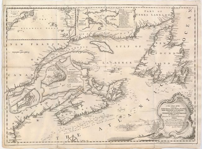
"A New Chart of the Coast of New England, Nova Scotia, New France or Canada, with the Islands of Newfoundld. Cape Breton St. John's &c…", Jefferys, Thomas

Subject: Colonial United States and Canada

Period: 1746 (published)

Publication: Gentleman's Magazine

Color: Black & White

Size:
18.5 x 13.5 inches
47 x 34.3 cm
Download High Resolution Image
(or just click on image to launch the Zoom viewer)

This uncommon map is based on Bellin's important map of the region done in 1744. The map includes New England as far south as Boston, the St. Lawrence River just beyond Quebec, and as far north as Cape Round. Coastal detail features soundings and the fishing banks. There are an array of nice insets placed inland including a large map of the Atlantic Ocean showing the American coastline to South Carolina, also "Plan of the City and Port of Louisbourg", "Fort Dauphin", and "City of Quebec". The large decorative title cartouche portrays a battle between war ships and a fortified city.

References: Kershaw #692, Jolly GENT-40.

Condition: B+

Fold splits and intersection splits repaired on verso.

Estimate: $250 - $300

Sold for: $275

Closed on 9/24/2008

Archived