Catalog Archive
Auction 125, Lot 123

"The Isles of Montreal, as they have been Survey'd by the French Engineers", Anon.
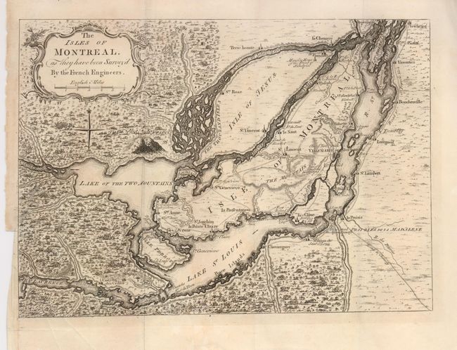
Subject: Canada

Period: 1761 (published)

Publication: London Magazine

Color: Black & White

Size:
12.8 x 9.3 inches
32.5 x 23.6 cm
Download High Resolution Image
(or just click on image to launch the Zoom viewer)

This interesting French and Indian War period map of Montreal and vicinity was based on the French maps initially drawn from manuscripts brought back to Paris by Pierre Francois Xavier de Charlevoix, a Jesuit who traveled extensively in Canada between 1705 and 1720. The map depicts the vicinity of Montreal, which was located at the navigable limits of the St. Lawrence River. Montreal or Ville Marie is depicted as a walled and fortified city. It is surrounded by many defensive forts that were built as protection against the Iroquois. Roads and trails are well depicted. The River St. Jean is shown as a wide channel clogged with islands, and several rapids and waterfalls are shown along the St. Laurence. This map was published just as news of the final British victory over Montreal was circulating in London.

References: Kershaw #1101; Jolly LOND-196; Sellers & Van Ee #616.

Condition: B+

Very nice example with great impression and wide margins. Binding side trim has a 1" tear closed on verso.

Estimate: $240 - $275

Sold for: $180

Closed on 9/24/2008

Archived