Catalog Archive
Auction 125, Lot 119

"America Septentrionalis a Domino d'Anville in Galliis edita nunc in Anglia Coloniis in Interiorem Virginiam deductis nec non Fluvii Ohio cursu…", Homann Heirs

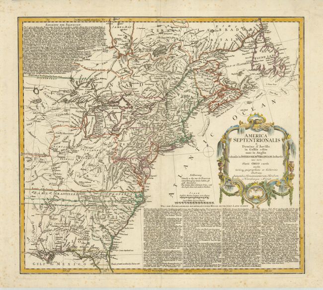
Subject: Colonial North America

Period: 1756 (dated)

Publication:

Color: Hand Color

Size:
20 x 18 inches
50.8 x 45.7 cm
Download High Resolution Image
(or just click on image to launch the Zoom viewer)

Informative and interesting map of colonial America from the French and Indian War period shows the area from James Bay and Newfoundland in the north to northern Florida and the Gulf of Mexico in the south. The map is based on Jefferys' map of 1755 for the political detail and applies D'Anville's cartography. It shows the British and French possessions from a British point of view. The western extent of the map is just west of the Mississippi River with Virginia, Earl Granvilles Property and North Carolina all extending off the map. The boundary of New York crosses Lakes Ontario, Huron and Erie to include the lower peninsula of Michigan. This map shows a very early Georgia, chartered in 1754. It is embellished with a large hand colored cartouche. The extensive text in German describing the British claims and French encroachments was taken from Jefferys' map published in the previous year.

References: McCorkle #756.1; Sellers & Van Ee #68.

Condition: B+

Crisp impression and nice coloring on a sheet with original margins. Light foxing in blank margins.

Estimate: $500 - $600

Sold for: $475

Closed on 9/24/2008

Archived