Catalog Archive
Auction 125, Lot 103

"Amerique Septentrionale Divisee en Ses Principales Parties, ou sont distingues les uns des autres Les Estats…", Elwe, Jan Barend

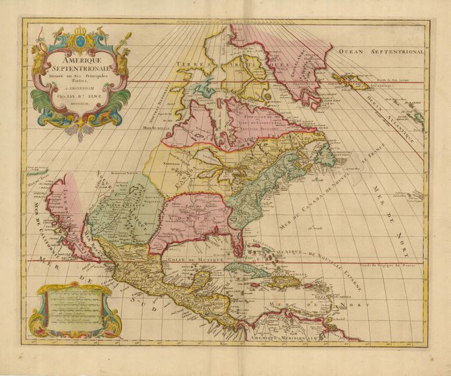
Subject: North America

Period: 1792 (dated)

Publication: Atlas

Color: Hand Color

Size:
23 x 18.3 inches
58.4 x 46.5 cm
Download High Resolution Image
(or just click on image to launch the Zoom viewer)

Large, decorative map copied from the Jaillot/Sanson map of 1674 with the same decorative title and scale of miles cartouches. It is possible the plate was acquired at the dissolution of the Jaillot firm in 1781, and revised with Elwe's imprint. The map has been somewhat updated with the western Great Lakes complete, and a peninsular California. Buttons Bay is open-ended, allowing the possibility of an inland passage to the Pacific. The R. del Norte originates from a large lake and empties into the Mer Rouge (Gulf of California). The political divisions are outdated with the continent still divided between the colonial interests of England, France and Spain. This very unusual and visually delightful map would be an important addition to any collection of North American maps.

References:

Condition: A

There is a minor extraneous crease along the centerfold, else fine with a couple of small spots and lovely original color.

Estimate: $1,200 - $1,500

Sold for: $1,000

Closed on 9/24/2008

Archived