Catalog Archive
Auction 124, Lot 176

"[Map of the Territories Surrounding the Geyser Basins]",

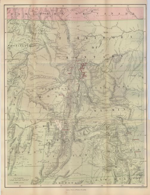
Subject: Western United States, Yellowstone National Park

Period: 1876 (published)

Publication: The Great Divide: Travels in Upper Yellowstone in the Summer of 1874

Color: Printed Color

Size:
14.3 x 18.3 inches
36.3 x 46.5 cm
Download High Resolution Image
(or just click on image to launch the Zoom viewer)

An interesting map showing the region visited by the Earl of Dunraven on an expedition to Yellowstone Park in 1874, shortly after it was established in 1872. The map provides great detail of the topography, watershed, place names, forts, Indian Reservations, fords, springs, landmarks, and the roads and railroads of the day. Places visited by the Earl are indicated by underlined red overprinting. The map covers the territories of Montana, Idaho, Wyoming, and Utah and extends to locate Taos, Denver and Colorado City, Humbolt, Nevada, and Walla Walla. The Earl was a peer of Ireland and showed great interest in the West; his book on the region raised public perception of the area, particularly overseas. The map title was derived from references in the book.

References: Blevins Wyoming #382.

Condition: B+

Folding, as issued. The map is fine less a 1.5" tear at the binding trim, that is closed on verso with archival tape.

Estimate: $120 - $160

Sold for: $90

Closed on 5/7/2008

Archived