Catalog Archive
Auction 123, Lot 704

"Tab. VII. Asiae, Exhibens Scythiam, intra Imaum Sogdianam, Bactrianam, Hircaniam, aliasq, Asiae Regiones", Ptolemy/Mercator

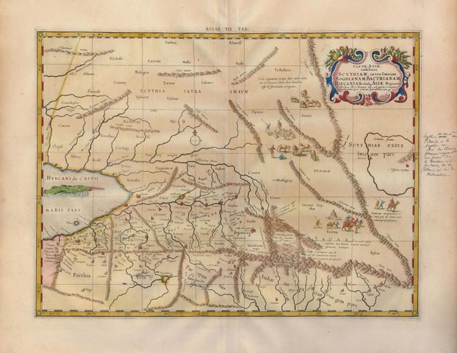
Subject: Central Asia

Period: 1730 (published)

Publication: Claudii Ptolemaei's Atlas Tabulae geographicae Orbis Terrarum

Color: Hand Color

Size:
18 x 13.4 inches
45.7 x 34 cm
Download High Resolution Image
(or just click on image to launch the Zoom viewer)

This fine copper engraved map covers Central Asia east of the Caspian Sea and what is now Turkestan, the Steppes, Afghanistan and beyond. The Himalayas and Northern India run across the bottom of the map. Mercator originally published this map in his 1578 edition of Ptolemy's great Geography. Although he is most renowned today for the projection he popularized and for first using the term Atlas for a collection of maps, he devoted much of his life to his Ptolemaic maps. The maps were beautifully engraved as nearly as possible to their original form and embellished with fine cartouches and cultural scenes. The map includes scenes of shepherds and their flocks and a great sea monster.

References: Mickwitz & Miekkavaara, (Nordenskiold-2) #235-13.

Condition: B

A nice impression on a sheet with generous margins. There are ink notations in the map and right margin.

Estimate: $275 - $325

Sold for: $200

Closed on 2/20/2008

Archived