Catalog Archive
Auction 123, Lot 465

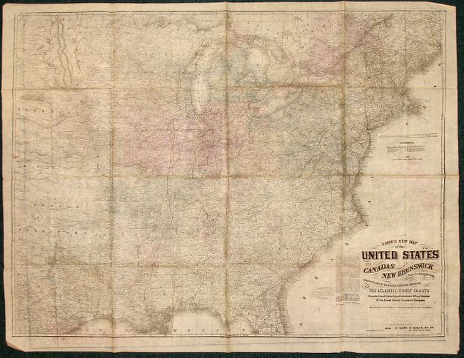
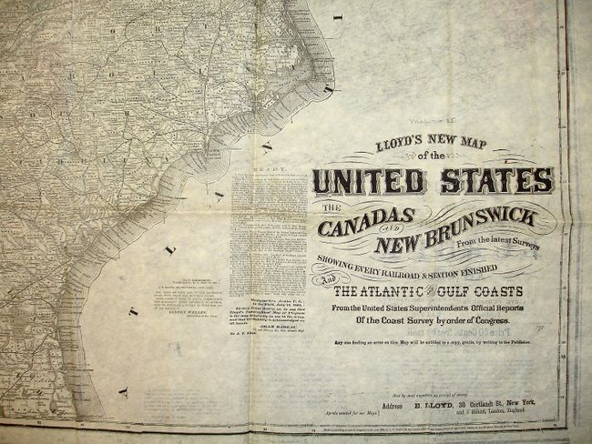
"Lloyd's Topographical and Railway Map of the Seat of War in Europe, 1870 [on verso] Lloyd's New Map of the United States the Canadas…", Lloyd, James T.
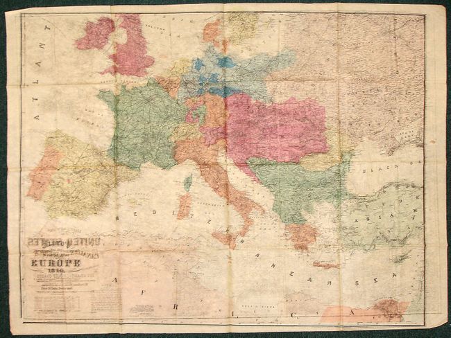
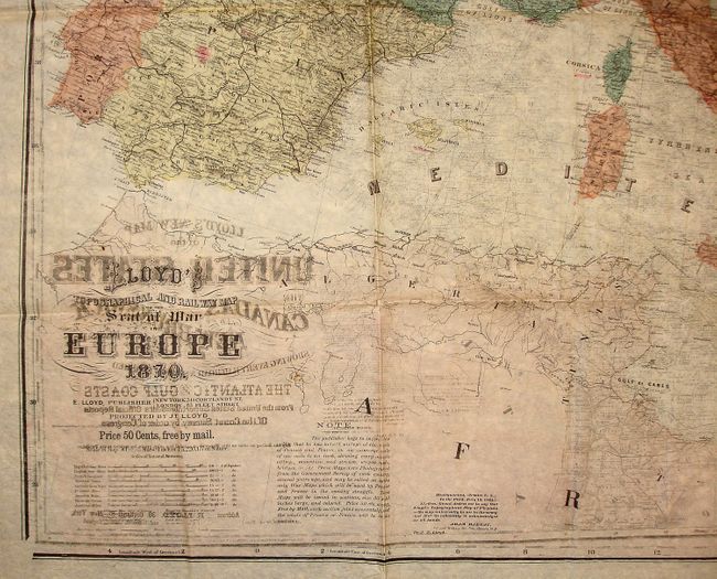
Subject: Europe

Period: 1870 (dated)

Publication:

Color: Hand Color

Size:
47 x 38 inches
119.4 x 96.5 cm
Download High Resolution Image
(or just click on image to launch the Zoom viewer)

Unusual, large, double-sided folded map showing an expansive Europe, from Iceland to Russia, with the northern coast of Africa below. This map was made during the Franco-Prussian War of 1870-71, the conflict which led to a unified Germany. The verso has an equally detailed map of the United States to the Dakotas, Indian Territory, Kansas and Texas on the verso. This large map is generally seen as a wall map, but this example is printed on fine banknote paper. Both maps are very detailed and filled with information, as well as notes from Lloyd advertising new maps and a note from Gideon Welles, the Secretary of the Navy, ordering a number of maps for the Mississippi River Squadron. There is a somewhat humorous note on the United States map cautioning the public against another mapmaker who goes by the name of 'Lloyd', by which name he hopes to deceive the public with spurious 'Lloyds' Maps'. This man's maps are coarsely engraved on wood and very erroneous. He follows us with an imitation of every map we issue.

References:

Condition: A

An exceptional example for the type of map it is, with original hand coloring. The paper has its characteristic crinkles and creases, and there is a small stain on the far left side of the map. "Map no. 25" written above U.S. title in pencil.

Estimate: $500 - $700

Unsold

Closed on 2/20/2008

Archived