Catalog Archive
Auction 123, Lot 349
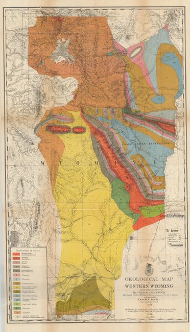
"Geological Map of Western Wyoming Illustrating the Report of Mr. Theo. B. Comstock", U.S. Army
Subject: Wyoming
Period: 1874 (dated)
Publication: Report upon the Reconnaissance of Northwestern Wyoming, Including Yellowstone…
Color: Printed Color
Size:
17.8 x 31 inches
45.2 x 78.7 cm
Download High Resolution Image
(or just click on image to launch the Zoom viewer)
(or just click on image to launch the Zoom viewer)