Catalog Archive
Auction 122, Lot 311

"North Carolina", Scott, Joseph
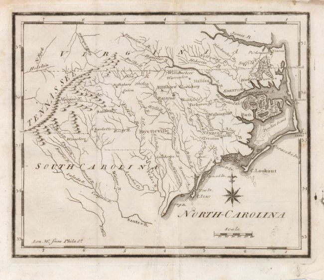
Subject: North Carolina

Period: 1800 (circa)

Publication: The New and Universal Gazetteer

Color: Black & White

Size:
7.5 x 6 inches
19.1 x 15.2 cm
Download High Resolution Image
(or just click on image to launch the Zoom viewer)

A charming and early American-produced copper engraved map in its second state. It locates Roanoke Island, Cape Fear and two swamps; the Gr. Alligator Dis. Swampalong the southern edge of the Albemarle Strait, and the Gr. Dismal Swamp along the northern edge. Tennasee is located just to the west of Charlotte. The map includes detail of the adjoining areas of Virginia and South Carolina. The western boundary is shown along the crest of the Blue Ridge Mountains instead of the Stone and Smoky Mountains, and the northwest boundary with Virginia is shown too far to the east.

References: Wheat & Brun #583

Condition: A

Folded, as issued, but with an extraneous crease. Edges a bit ragged. Some light foxing mostly confined to margins.

Estimate: $200 - $250

Sold for: $190

Closed on 12/5/2007

Archived