Catalog Archive
Auction 122, Lot 207

"Florida, et Regiones Vicinae", Gerritsz/De Laet

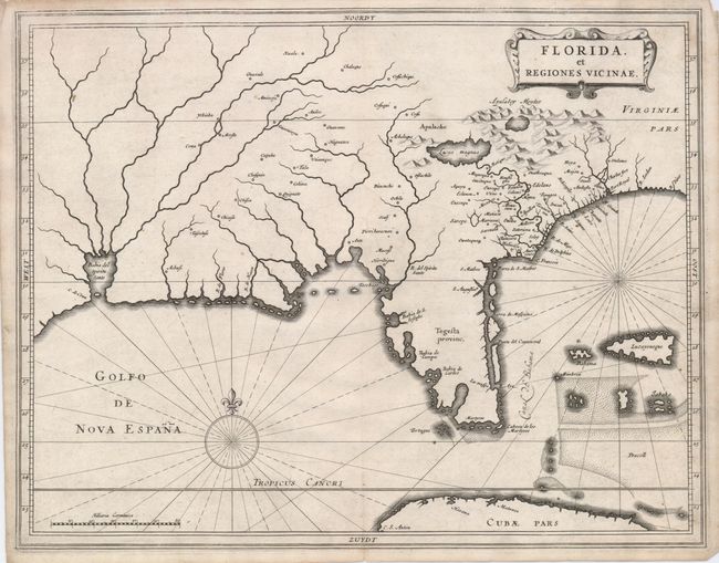
Subject: Colonial South

Period: 1630 (published)

Publication: Nieuwe Wereldt ofte Beschrijvinghe van West-Indien…

Color: Hand Color

Size:
14 x 11 inches
35.6 x 27.9 cm
Download High Resolution Image
(or just click on image to launch the Zoom viewer)

This is one of three maps of North America that were included in De Laet's important work on the Americas. It greatly influenced the subsequent work of Blaeu, Jansson and Sanson. It is likely the work of Hessel Gerritsz, who drew on the cartography of Jacques le Moyne, as interpreted by Claesz. The Florida Peninsula is here named Tegesta provinc, the name of an Indian tribe that lived on the southwest coast, while the larger region is called Florida. Much of the other nomenclature was drawn from the Chaves/Ortelius map of 1584 with the notable additional place names of St. Augustine and Tampa Bay. Near the western border is the Bahia del Spiritu Santo which is fed by several large rivers.

References: Burden #232; Cumming (SE) #34.

Condition: A

A superb impression on a sturdy sheet with attractive color. One small chip in the upper right blank margin, well away from map.

Estimate: $3,750 - $4,500

Sold for: $3,250

Closed on 12/5/2007

Archived