Catalog Archive
Auction 122, Lot 17

"Novus Planiglobii Terrestris per Utrumque Polum Conspectus", Blaeu/Valck
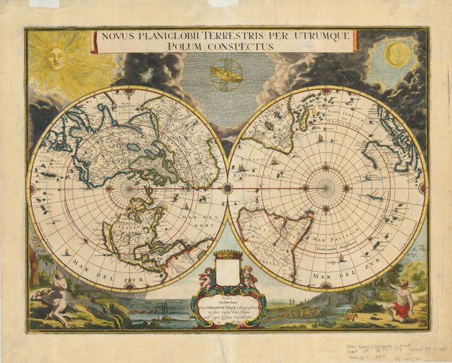
Subject: World

Period: 1695 (circa)

Publication:

Color: Hand Color

Size:
21.4 x 16 inches
54.4 x 40.6 cm
Download High Resolution Image
(or just click on image to launch the Zoom viewer)

This uncommon, beautifully engraved map showing the world on a polar projection was the final world map executed by Johannes Blaeu in circa 1672. A tragic fire destroyed the Blaeu company that same year before the map was published. The plate itself survived and was acquired by Gerald Valck, who replaced Blaeu's imprint with his own. Traces of the original imprint can still be discerned in the cartouche. The map shows California as an island; the only Blaeu map to depict this cartographic myth. In the Pacific, the coastline of Australia is beginning take shape. In South America, the mythical Parime Lacus is shown on the Equator, and the southern tip of the continent is oddly truncated due to the projection. Surrounding the map are billowing clouds, the sun, moon and an armillary sphere at top. The bottom of the map shows Eve emerging from the rib of Adam on the left, and on the right, a clothed and ashamed Adam is about to depart the Garden of Eden.

References: Shirley #459.

Condition: A

An exceptional impression with lovely color. There is an area of paper in the top left corner weakened by the platemark, now reinforced with archival tape on the verso. The top and bottom margins have a tear that just touches the border, and is now professionally mended. Linen hinge remnants in the top margin.

Estimate: $7,500 - $9,500

Sold for: $6,500

Closed on 12/5/2007

Archived