Catalog Archive
Auction 122, Lot 116

"North America in its Present Divisions, agreeable to the Peace", Stackhouse, Thomas

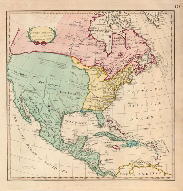
Subject: North America

Period: 1794 (circa)

Publication: An Universal Atlas

Color: Hand Color

Size:
14.8 x 14.8 inches
37.6 x 37.6 cm
Download High Resolution Image
(or just click on image to launch the Zoom viewer)

This is an uncommon later edition of one of the first maps to show the political divisions of North America following the Revolutionary War. This map lacks the date of 1783 seen on the earlier editions, but evidence of it is still seen within the cartouche. The divisions are noted in color for the United States (yellow), Britain (red), Spain (green), and France (blue). The fictional River of the West is shown in a dotted line extending from the West Coast to Lake Winnipeg.

References:

Condition: B+

Original color and a strong impression on a sheet with a faint stain near the Yucatan and some faint uneven toning.

Estimate: $600 - $800

Sold for: $450

Closed on 12/5/2007

Archived