Catalog Archive
Auction 121, Lot 780

"[Lot of 3] Aegyptus Inferior sive Delta [and] Mauretania et Numidia [and] Le Coste di Barbaria Ouvero I Regni di Marocco di Fez di Algeri di Tunisi di Tripoli coi Paesi Circonvicini", [blank]

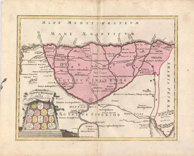
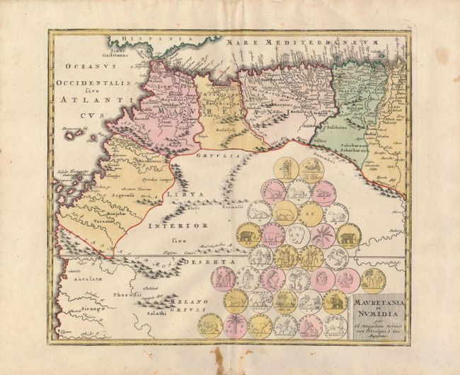
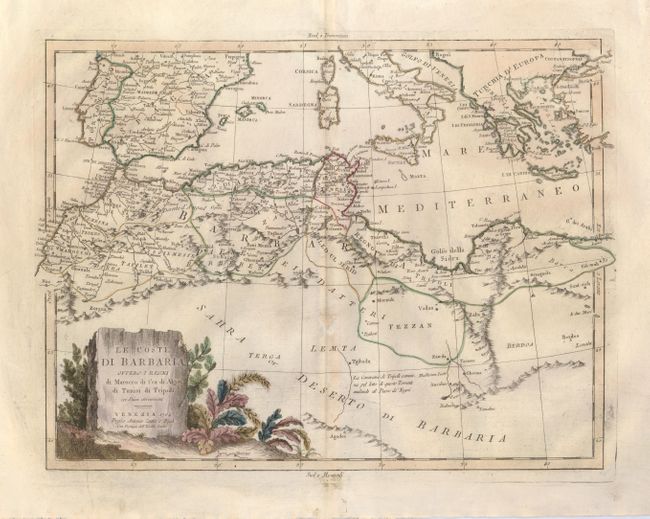
Subject: North Africa and Egypt

Period: 1720-1784 (circa)

Publication:

Color: Hand Color

Size:
See Description
Download High Resolution Image
(or just click on image to launch the Zoom viewer)

An attractive trio of 18th century maps detailing the coastal area of ancient North Africa.

1) Aegyptus Inferior sive Delta is a sharply engraved map of ancient Egypt covering the Nile Delta region. Major cities are shown with an extensive network of roads and the pyramids are prominent. The title cartouche incorporates several Egyptian coins. The map is by Christopher Weigel, circa 1720 (15.8 x 12.3").
2) Mauretania et Numidia is an interesting map covering northwestern Africa from Bizerta to Cape Verde. The mapmaker, Christopher Weigel, assigned Ptolemaic place-names to then-current geography making this an interesting map. The interior is filled with an assembly of ancient coins and the title is engraved onto a stone block. Circa 1720 (14.5 x 12.5")
3) Le Coste di Barbaria Ouvero I Regni di Marocco di Fez di Algeri di Tunisi di Tripoli coi Paese Circonvicini is an uncommon map of the northern part of Africa that extends to show much of the Mediterranean, including the southern portions of Spain and Italy. The title is displayed on a handsome monument within a cluster of exotic plants. This map is by Antonio Zatta, dated 1784 (16 x 12").

References:

Condition: B

Maps 1 and 2 are sound with nice color. There are a few scattered stains, with the largest ones confined to the margins. Map 3 is a crisp impression on a sheet with a small repaired hole in an unengraved area in the upper right corner of the map and some faint toning on the centerfold.

Estimate: $250 - $300

Sold for: $180

Closed on 9/26/2007

Archived