Catalog Archive
Auction 121, Lot 438

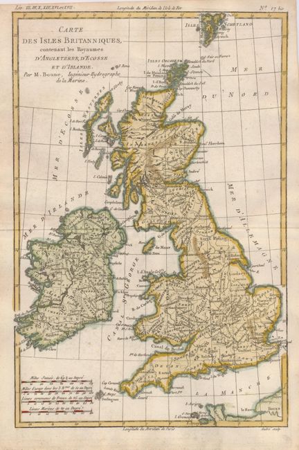
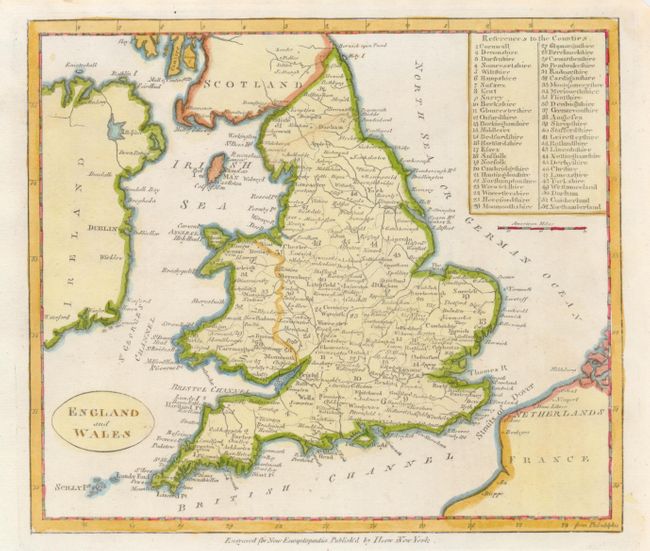
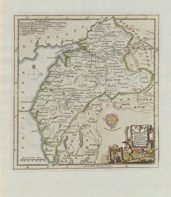
"[Lot of 3] Carte des Isles Britanniques, Contenant les Royaumes d'Angleterre, d'Ecosse et d'Irlande [together with] England and Wales [and] Cumberland Drawn from the Best Surveys, Maps, Charts, &c. & Regulated by Astron. Observations", [blank]

Subject: Britain

Period: 1764-1800 (circa)

Publication:

Color: Hand Color

Size:
See Description
Download High Resolution Image
(or just click on image to launch the Zoom viewer)

An attractive trio of 18th century maps of Britain.

1) Carte des Isles Britanniques, Contenant les Royaumes d'Angleterre, d'Ecosse et d'Irlande is a sharply engraved map of England, Wales, Scotland and Ireland by Rigobert Bonne and engraved by Andre, circa 1787. (8.3 x 12.5")
2) This small map of England and Wales was published by I. Low in the New Encyclopaedia, in New York. The map has a numbered key at top right corresponding to the counties. The map is circa 1800, (8.4 x 7.3").
3) Cumberland Drawn from the Best Surveys, Maps, Charts, &c. & Regulated by Astron. Observations is a delicately engraved little map of Cumberland showing excellent detail, including Hadrian's Wall (The Picts Wall). The key at the top left shows the symbols for borough towns, parishes, market towns, post roads, open and healthy roads, crossroads and parks. The map has a charming cartouche with a barnyard and chickens. The map is by Thomas Kitchen, published circa 1764.

References:

Condition: A

Maps 1 and 2 maps with irregular, trimmed margins, still sufficient for framing, Map 3 is fine.

Estimate: $200 - $250

Sold for: $150

Closed on 9/26/2007

Archived