Catalog Archive
Auction 121, Lot 39

"Les Deux Poles Arcticque ou Septentrional, et Antarcticque ou Meridional…", Sanson/Mariette
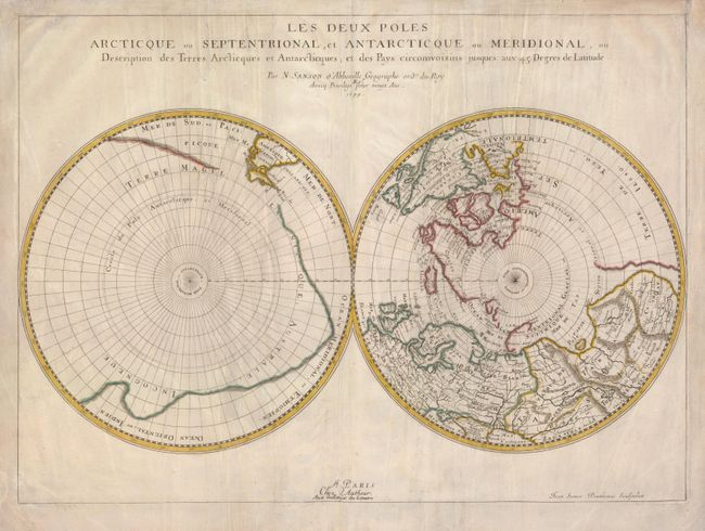
Subject: Polar

Period: 1679 (dated)

Publication:

Color: Hand Color

Size:
21 x 15.3 inches
53.3 x 38.9 cm
Download High Resolution Image
(or just click on image to launch the Zoom viewer)

This map is focused on the north and south poles and illustrates the extent of exploration in the regions. In the Northern Hemisphere, Greenland is depicted attached to the American continent, and it is hinted that Terre de Yezo, ou Iesso takes up the entire region between Buttons Bay and East Asia. In the Southern Hemisphere, the tip of South America is shown with the Strait of Magellan and Le Maire Strait. The balance of the map is filled with a large landmass labeled Terre Magellanicque, Australe, et Incogneue. Second state engraved by Jean Somer Pruthenus and published by Pierre Mariette.

References: Kershaw #145.

Condition: B

The map has nice original color on a sheet with some creases that have been reinforced on the verso with tissue, filled wormholes and one pinhole on the South Pole. The margins have some short tears, some of which have been repaired on the verso.

Estimate: $400 - $500

Sold for: $300

Closed on 9/26/2007

Archived