Catalog Archive
Auction 121, Lot 292

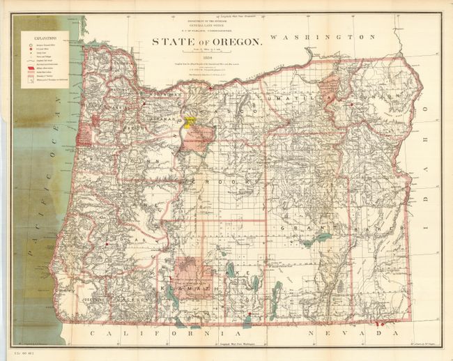
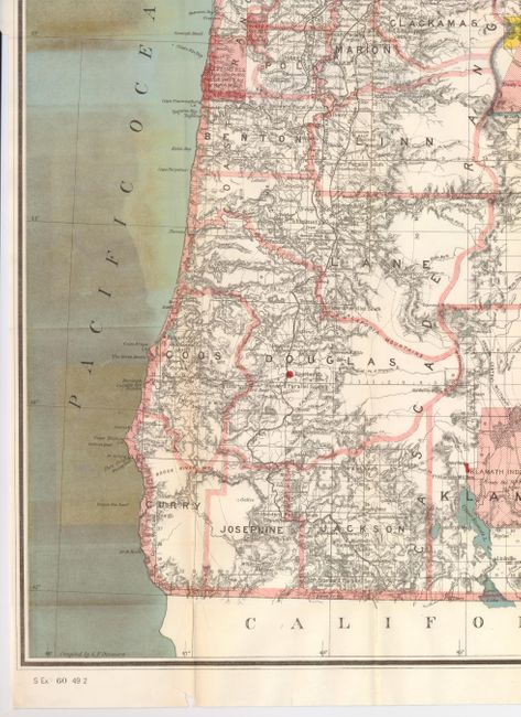
"State of Oregon", General Land Office

Subject: Oregon

Period: 1884 (dated)

Publication: Senate Doc. #60, 49th Congress, 2nd Session

Color: Printed Color

Size:
30 x 22.5 inches
76.2 x 57.2 cm
Download High Resolution Image
(or just click on image to launch the Zoom viewer)

Fine map by G.P. Strum has abundant detail with topography and hydrology nicely developed. This county map was drawn by W. Naylor. The legend identifies military posts, Indian reservations, completed railroads, railroad land grants, etc. Also details the granted and indemnity limits of wagon roads. Grid along bottom shows longitude west from Washington. Lithography and printing by the renowned firm of Julius Bien in New York City.

References:

Condition: B+

Issued folding, now pressed and backed with tissue. A few small fold splits in margins, and some toning in the Pacific and just a hint on two folds. Small chip in bottom margin, well away from map border.

Estimate: $120 - $160

Sold for: $65

Closed on 9/26/2007

Archived