Catalog Archive
Auction 121, Lot 279

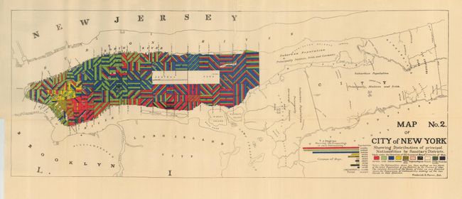
"Map No. 2 of City of New York Showing Distribution of Principal Nationalities by Sanitary Districts", Pierce, Frederick

Subject: New York City

Period: 1894 (dated)

Publication:

Color: Printed Color

Size:
28.75 x 11.8 inches
73 x 30 cm
Download High Resolution Image
(or just click on image to launch the Zoom viewer)

This interesting and uncommon thematic map graphically describe the populations of nationalities "making up two thirds of the total population of any district by the census of 1890" throughout Manhattan. The city's districts cover the island from The Battery to 140th Street in a colorful mosaic pattern explained by the legend. The populations in districts outside of Manhattan are summarized, for example, as "Principally Natives, Irish and Germans." Drawn by Frederick E. Pierce.

References:

Condition: A

This near fine example has only a couple tiny fold intersection splits.

Estimate: $100 - $150

Sold for: $75

Closed on 9/26/2007

Archived