Catalog Archive
Auction 121, Lot 218

"Reconnaissance of the Tulares Valley", Derby, George Horatio (Lt)
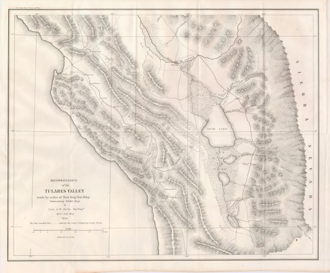
Subject: California

Period: 1850 (dated)

Publication: Senate Doc. #110, 32nd Congress, 1st Session

Color: Black & White

Size:
18.2 x 14.7 inches
46.2 x 37.3 cm
Download High Resolution Image
(or just click on image to launch the Zoom viewer)

This interesting map of the area south of the San Joaquin River from the Pacific Ocean to the foothills of the Sierra Nevada Mountains was not published until 1852. The Road to Los Angeles runs through the center of the map. This road offers two routes to LA on either side of Tache Lake with the eastern-most route running along the base of the Sierra Nevada Mountains. The road from Monterey to San Louis Obispo names several villages along the way including Tores, Guadalupe, Soledad, Ojitas and Paso de Rables (sic). Derby's route is traced by dashed lines and several mountain passes are noted. Further, the map locates Warsaw on the road to Los Angeles at the River San Joarquin, and other interesting features such as "Wild Horses." Wheat calls this a map of major importance to the California Gold Rush. A nice, bright example.

References: Wheat (Gold) #150.

Condition: A

A small fold split in margin repaired on verso with archival tape.

Estimate: $110 - $140

Sold for: $80

Closed on 9/26/2007

Archived