Catalog Archive
Auction 121, Lot 191

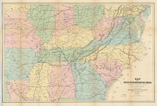
"Map of the United States Military Railroads Showing the Rail Roads Operated During the War from 1862-1866…", U.S. Government

Subject: United States - Southeast

Period: 1866 (dated)

Publication:

Color: Hand Color

Size:
38 x 24.5 inches
96.5 x 62.2 cm
Download High Resolution Image
(or just click on image to launch the Zoom viewer)

This interesting hand colored map, produced by J. Bien, provides a clear picture of the railroads involved in the theatre of operations during the Civil War. The railroad tracks using a gauge of 5 ft., 4 ft. 8 1/2 in., and 5 ft. 6 in. are color coded. Large enough so one can easily track military operations and troop movements.

References:

Condition: B+

Issued folded and now pressed and backed with archival tissue. Lightly toned at some folds, and a couple small intersectional fold splits supported on verso, else a near fine example.

Estimate: $300 - $400

Sold for: $220

Closed on 9/26/2007

Archived