Catalog Archive
Auction 121, Lot 177

"Geographisch-Statistiche und Historische Charte von Maryland", Weimar Geographisches Institut

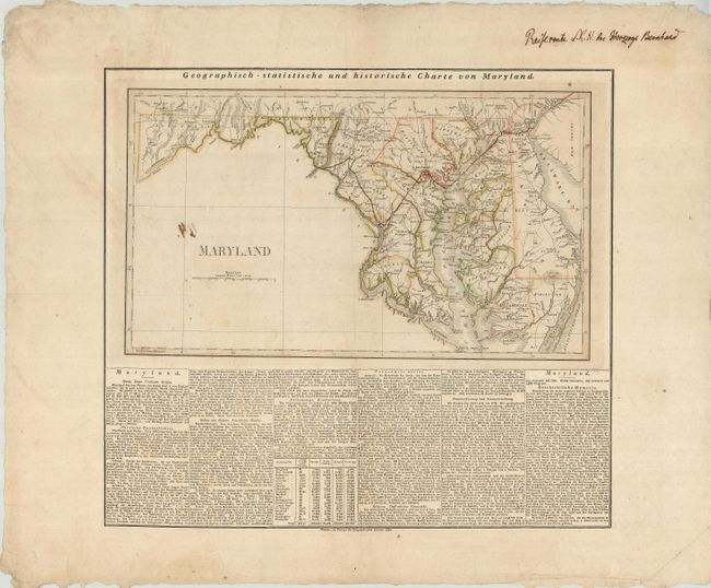
Subject: Maryland and Delaware

Period: 1826 (dated)

Publication: American Atlas

Color: Hand Color

Size:
19.2 x 11.2 inches
48.8 x 28.4 cm
Download High Resolution Image
(or just click on image to launch the Zoom viewer)

This map is above a panel of extensive German text relating to Maryland - geography, history, population, government, etc. (print area 21 x 19"). The map depicts individual counties, towns, villages, roads, rivers, lakes, swamps and coastal features. An old ink notation in the top margin reads, "Reiseroute S. (einer)K. (oniglichen) H. (oheit) Des Herzogs Bernhard." Translated, it means, "Travel route of His Royal Highness Duke Bernhard." A finely-drawn line, in the same ink, tracesa route from Delaware Bay to the Chesapeake and then to Baltimore, Washington, D. C. Fredrickstown and finally to Harper's Ferry. At first glance the line appears to be part of the outline coloring. Duke Bernhard was an important European observer in the United States, who in 1828 published an account of his travels in the U.S. The notation on the map describes his route accurately, and given the origin, language and dating of the map, it is quite possible the notation was penned by a contemporary of the Duke.

References:

Condition: B

There is an ink stain on the blank area of the map. There is a small tear to the right of Washington, D. C, and one more in the right portion of the map at top. Very wide original margins with some chipping and creasing at the edges and a couple small, crescent shaped tears in the right margin.

Estimate: $150 - $200

Sold for: $220

Closed on 9/26/2007

Archived