Catalog Archive
Auction 121, Lot 158

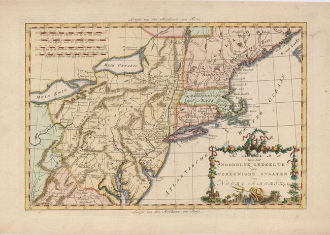
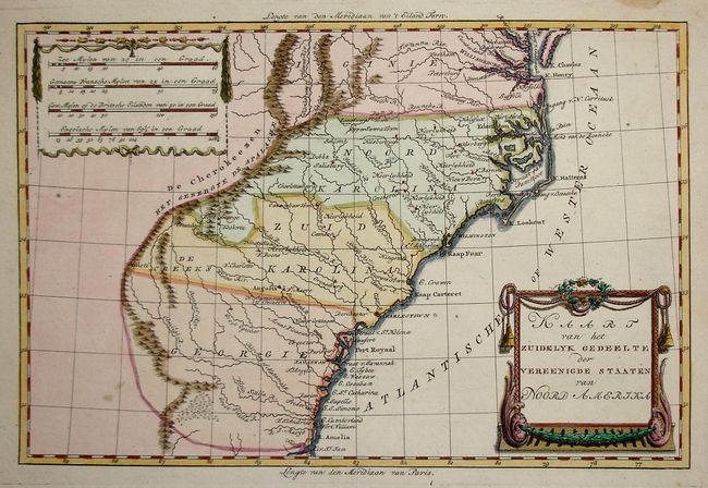
"[Lot of 2] Kaart van het Noordlyk Gedeelte der Vereenigde Staaten van Noord Amerika [and] Kaart van het Zuidelyk Gedeelte der Vereenigde Staaten van Noord Amerika", Bachiene, Willem Albert

Subject: United States - Eastern

Period: 1785 (circa)

Publication: Atlas tot Opheldering der Hedendaagsche Historie…

Color: Hand Color

Size:
12.6 x 8.3 inches
32 x 21.1 cm
Download High Resolution Image
(or just click on image to launch the Zoom viewer)

An uncommon matched pair of maps based on Bonne, covering the territory of the newly created United States, both with decorative cartouches and scales of miles.

1) Kaart van het Noordlyk Gedeelte der Vereenigde Staaten van Noord Amerika covers the region from northern Virginia to northern Maine (Massachuset Baay) and west to the Ohio River and lakes Ontario and Erie. The map is filled with good topographical detail including numerous settlements, forts, and Indian villages. The cartouche is festooned with ribbons and garlands of fruit.
2) Kaart van het Zuidelyk Gedeelte der Vereenigde Staaten van Noord Amerika details the region from the states of Virginia, North & South Carolina, and Georgia. All settlement is confined east of the Appalachians with Dez Cherokeezen the only note in the otherwise blank region west of the mountains. There are four distance scales located on the left side of the map, and the cartouche is delicately engraved.

References: 1) cf McCorkle #782.1; cf Sellers & van Ee #744. 2) cf Sellers & Van Ee #1406.

Condition: A

Some minor soil in margins.

Estimate: $600 - $700

Sold for: $450

Closed on 9/26/2007

Archived