Catalog Archive
Auction 120, Lot 475

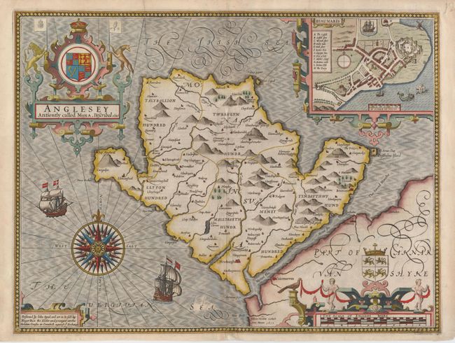
"Anglesey Antiently called Mona, Described", Speed, John
Subject: Wales

Period: 1610 (circa)

Publication:

Color: Hand Color

Size:
20 x 15 inches
50.8 x 38.1 cm
Download High Resolution Image
(or just click on image to launch the Zoom viewer)

Lovely map of the island in northern Wales, filled with many Welsh place-names and pictorial representations of topography. There is a spectacular compass rose orienting the map and beautifully engraved ships sailing the seas. The map is inset with a plan of Beaumaris, showing the famous castle and the surrounding countryside and sea, decorated with its own ships and sea monsters. A bold strapwork cartouche surmounts the map. Engraved by Jodocus Hondius, with the imprint of Roger Rea, published circa 1662. Related English text on the verso.

References:

Condition: B

Lovely impression and color, and good original margins. Centerfold repaired with a small amount of abrasion, and one printer's crease. There are a few short chips in the margins, not affecting the map.

Estimate: $600 - $700

Sold for: $750

Closed on 7/18/2007

Archived