Catalog Archive
Auction 120, Lot 412

"The Island of Barbadoes, Revised by J. W. Norie", Norie, John William
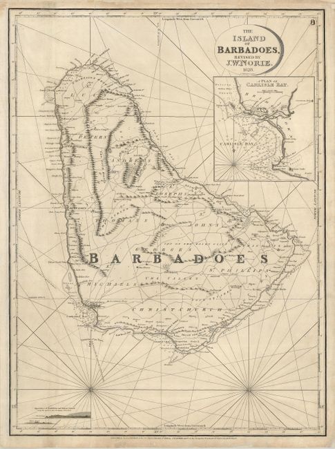
Subject: Barbados

Period: 1828 (dated)

Publication:

Color: Black & White

Size:
18.5 x 25 inches
47 x 63.5 cm
Download High Resolution Image
(or just click on image to launch the Zoom viewer)

Scarce, large-scale chart of Barbados, including a detailed inset Plan of Carlisle Bay and coastal perspectives of North Point and Pelican Island. The map shows roads, forts, government houses, Quaker meeting houses, and soundings. Holetown, Bridgetown, Oistins Bay and Speightstown are some of the many place-names featured on the map. Published by J. W. Norie at the Navigation Warehouse, No. 157 Leadenhall St. This preiminent cartographic firm exists today as Imray, Laurie, Norie & Wilson Ltd, still specializing in nautical charts.

References:

Condition: B

Sharp impression on sturdy paper that is slightly soiled. The margins have been reinforced with tissue on the verso, as has a fold on the left.

Estimate: $750 - $850

Sold for: $500

Closed on 7/18/2007

Archived