Catalog Archive
Auction 120, Lot 393
"A Draught of the Harbours of Port Royal and Kingston, in Jamaica. With the Fortifications Correctly Laid Down; also all the Keys and Shoals Adjacent", Bew, John
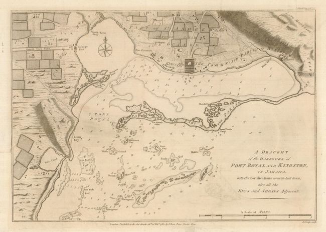
Subject: Jamaica
Period: 1782 (dated)
Publication: Political Magazine
Color: Black & White
Size:
14.6 x 10.25 inches
37.1 x 26 cm
Download High Resolution Image
(or just click on image to launch the Zoom viewer)
(or just click on image to launch the Zoom viewer)