Catalog Archive
Auction 120, Lot 287

"A Plan of Chicago Harbor Lake Michigan", Cram, Thomas Jefferson (Capt.)

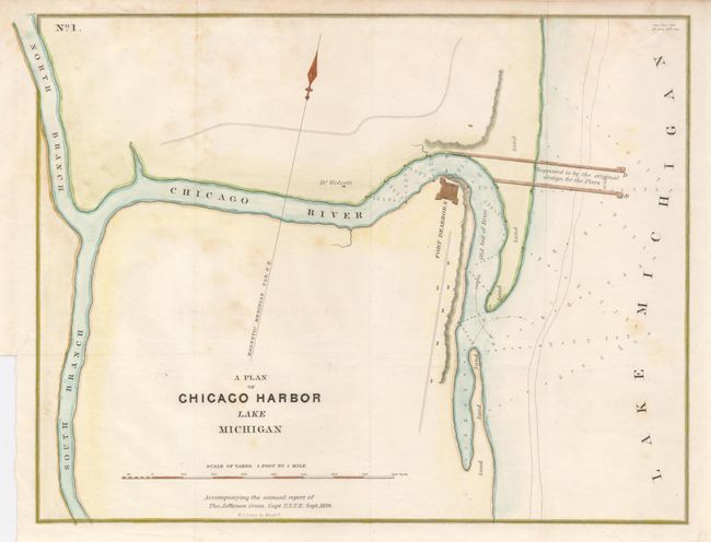
Subject: Chicago, Illinois

Period: 1839 (dated)

Publication:

Color: Hand Color

Size:
14.5 x 11.5 inches
36.8 x 29.2 cm
Download High Resolution Image
(or just click on image to launch the Zoom viewer)

The earliest map of Chicago harbor that we have seen, when the population of the entire city was about 4500. Fort Dearborn, the first recognized structure of Chicago and Dr. Wolcoot's residence are the only two buildings located. Soundings are noted in the Chicago River and Lake Michigan.

Thomas Jefferson Cram (1804-1883) was born in New Hampshire and graduated fourth in his class from the United States Military Academy in West Point, New York. In 1838, he joined the U. S. (Army) Topographical Engineers, where he received a captain's commission and was assigned to the Great Lakes harbor surveys. In the 1840s he surveyed the Michigan and Wisconsin boundary, and in 1855 he became Chief of the Topographical Engineers, Western Division. He was promoted to Lt. Colonel in 1861, served with distinction in the Civil War and was rewarded with the title of Brevet General in 1866. He retired in 1869.

References: Phillips (M) p. 230.

Condition: B

Some faint foxing, still a nice example.

Estimate: $275 - $350

Sold for: $2,100

Closed on 7/18/2007

Archived