Catalog Archive
Auction 120, Lot 215

"Colton's Map of the Southern States", Colton, G.W. & C.B.

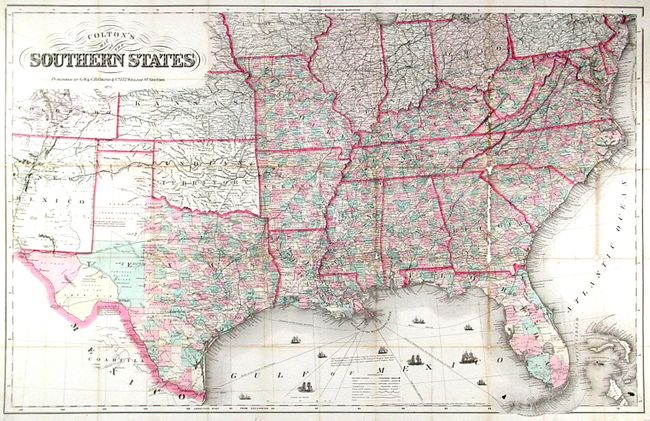
Subject: Southern United States -

Period: 1875 (dated)

Publication:

Color: Hand Color

Size:
38.5 x 24.2 inches
97.8 x 61.5 cm
Download High Resolution Image
(or just click on image to launch the Zoom viewer)

This rarely seen pocket map describes the southern and border states during the Reconstruction period. On a scale of forty-eight miles to the inch it has excellent detail throughout, particularly in the western areas where Kansas, the Indian Territory, Texas, and part of Colorado and New Mexico are well shown. The Gulf of Mexico is filled with sailing ships which, according to the Library of Congress, are engaged in the Union blockade of southern harbors. Lacking the covers and archivally mounted on a 100% rag board.

References:

Condition:

Toned with small loss along one fold line. The consignor reports that the map has been "restored by deacidification and laminated onto acid-free board. This item was professionally restored in the 1970s by the W.J. Barrow Restoration Shop, a leader in conservation methods, including de-acidification and mounting on cellulose acetate film." This mounting technique suggests it's easily reversed, which was recently accomplished on another map so treated.

Estimate: $600 - $800

Unsold

Closed on 7/18/2007

Archived