Catalog Archive
Auction 120, Lot 202

"Map of Pennsylvania and New Jersey", Tanner, Henry Schenck

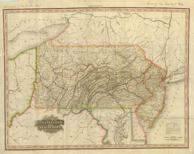
Subject: Pennsylvania, New Jersey

Period: 1825 (dated)

Publication:

Color: Hand Color

Size:
27 x 20.5 inches
68.6 x 52.1 cm
Download High Resolution Image
(or just click on image to launch the Zoom viewer)

Separately issued pocket map, identical to the map in the American Atlas, is here printed on fine bank note paper. The large map exhibits very fine detail throughout including battle grounds, Public Houses, towns & villages, mills, iron works, topography and much more. Revised from the August 20, 1823 edition. Uncommon issue is without the original gilt 12mo covers. This large Tanner map folds to 4.5" x 6".

References:

Condition: B+

Folding, as issued with full margins and original color. The map image is very good but with some soft fold lines and a little light foxing or offsetting evident in blank areas. In blank upper margin are two ink notes related to ownership.

Estimate: $350 - $500

Sold for: $275

Closed on 7/18/2007

Archived