Catalog Archive
Auction 119, Lot 632

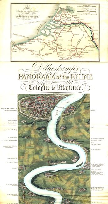
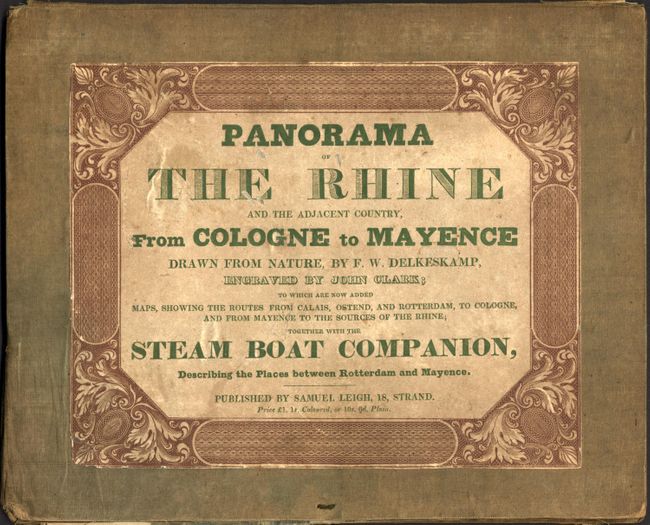
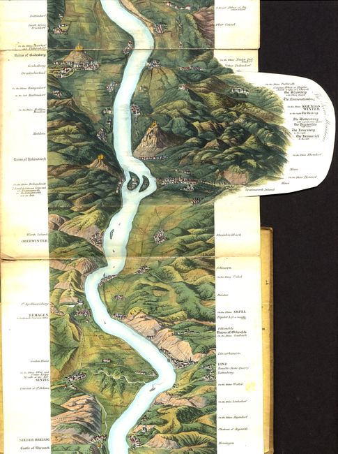
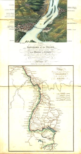
"Delkeskamp's Panorama of the Rhine and the Adjacent Country from Cologne to Mayence", Delkeskamp, Friedrich Wilhelm
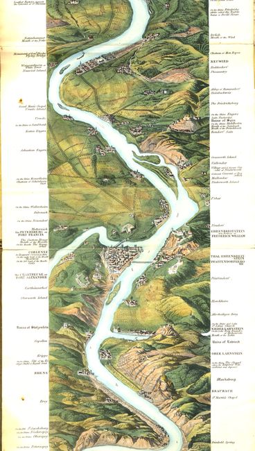
Subject: Germany

Period: 1830 (circa)

Publication:

Color: Hand Color

Size:
7.5 x 106.5 inches
19.1 x 270.5 cm
Download High Resolution Image
(or just click on image to launch the Zoom viewer)

This is an exceptional, panoramic, folding map. The remarkable bird's-eye view follows the entire length of the river, using subtle tonal variations to display the topography of the lush countryside. The map was prepared using the aquatint technique and the artist craftsmanship includes painstaking attention to detail, such as the delicate coloring of the rooftops of hundreds of miniature buildings. A small foldout section allows for the inclusion of the Seven Mountains region. Two additional maps, Map Showing the Various Routes From London to Cologne and Map Showing the Various Routes From Cologne to the Sources of the Rhine make this unusual view a real treasure. The "Steam Boat Companion" is missing. Map folds accordion style into green cloth boards with decorative paper pastedown title (8 x 10").

Delkeskamp issued a series of plate-books and panoramas based on his tours of Germany and Switzerland. His Rhein-Panorma was first published in 1825. The engraver, John Heaviside Clark, was well known for his architectural and landscape drawings, especially his aquatints.

References:

Condition: B

The map with exquisite original hand coloring. Several minor fold separations and some light scattered foxing. Covers are shelf worn with some loss, a bit scuffed and are partially separated.

Estimate: $900 - $1,200

Unsold

Closed on 5/9/2007

Archived