Catalog Archive
Auction 119, Lot 273

"Map of the Upper Part of Lake County, Indiana, and the Calumet Manufacturing District, Cook County, Ill.", Rand McNally & Co.

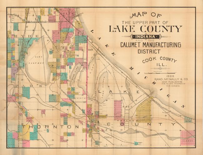
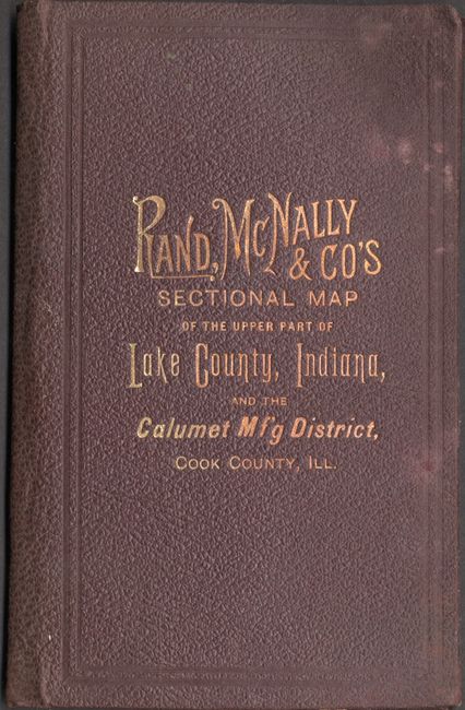
Subject: Chicago, Illinois and Indiana

Period: 1888 (dated)

Publication:

Color: Hand Color

Size:
33 x 25.3 inches
83.8 x 64.3 cm
Download High Resolution Image
(or just click on image to launch the Zoom viewer)

A very large and colorful map of southeastern Chicago showing early subdivisions including Washington Heights, Hyde Park and Notre Dame. This wonderful example also locates the lighthouse in Camden Harbor, as well as the railways, lakes, rivers, bridges and some of the industry in this section of one of America's most loved cities. The giant title is located in the upper right portion of the map where Lake Michigan is situated. The map folds into brown cloth covers (4.3 x 7") with a gilt title on front.

References:

Condition: B

Map with some minor toning and the usual tiny intersection splits, and a light stain where the paper is adhered to the back cover. Covers are lightly soiled, otherwise fine.

Estimate: $475 - $550

Sold for: $550

Closed on 5/9/2007

Archived