Catalog Archive
Auction 119, Lot 213

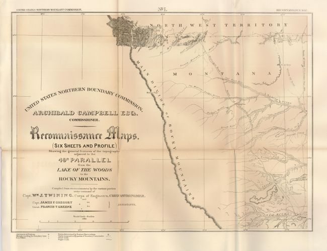
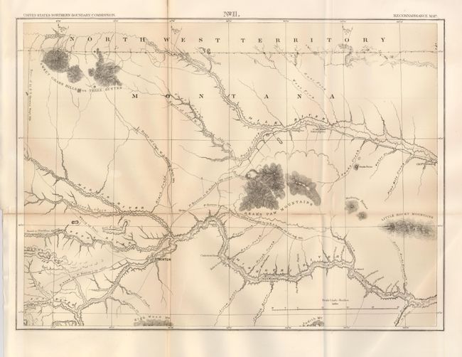
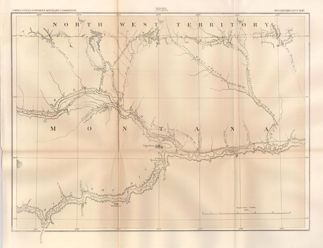
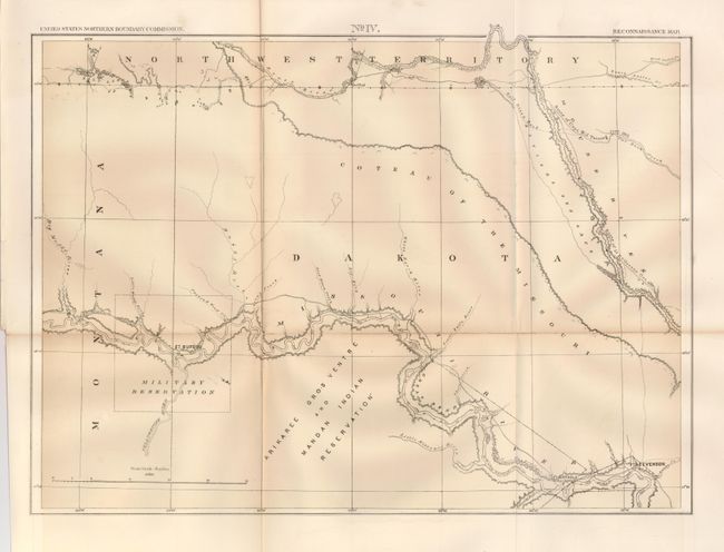
"[Lot of 7] Reconnaissance Maps. (Six Sheets and Profile) Showing…adjacent to the 49th Parallel from the Lake of the Woods to the Rocky Mountains", Twining, William J. (Capt.)

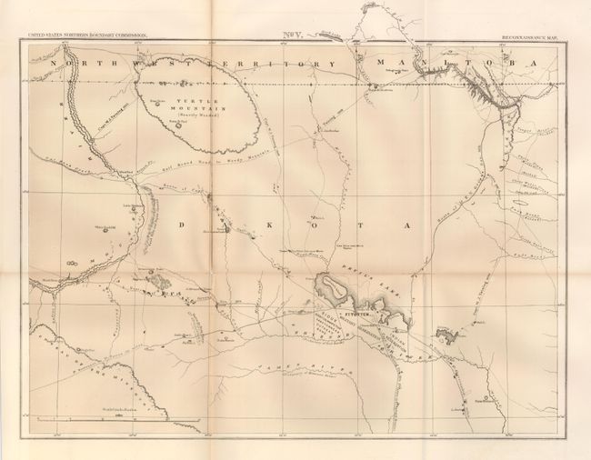
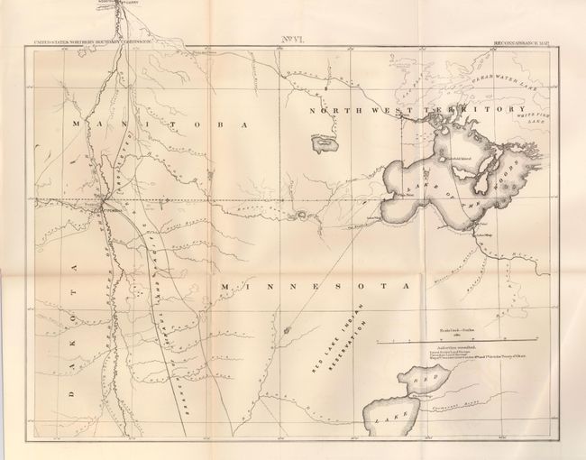
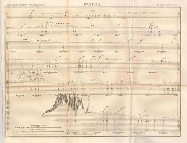
Subject: United States - Upper Midwest

Period: 1878 (published)

Publication: U.S. Northern Boundary Commission

Color: Black & White

Size:
21.3 x 15.4 inches
54.1 x 39.1 cm
Download High Resolution Image
(or just click on image to launch the Zoom viewer)

Complete and matching set of all six maps and one profile sheet of the Northern Boundary Survey. In 1872, Congress authorized a survey to determine and mark the U.S. - Canadian Boundary line along the 49th parallel. The survey accurately determined the boundary, and added very detailed topographical features in a 5-mile wide strip along the line. The survey was completed in 1875 and published by Archibald Campbell and William Twining in 1878. These maps cover the area from the Rocky Mountains in Montana to the Lake of the Woods in Minnesota and 100 miles north to south. They provide excellent detail of rivers, towns and forts, springs, and topographical data. Locates the Blackfoot Indian Agency, Ft. Shaw, Ft. Benton, River Crow Indian Agency, Ft. Belknap, Old Fr. Browning, Ft. Turnay, Ft. Peck, Ft. Hawley, Ft. Buford, Ft. Berthold, Ft. Stevenson, Ft. Totten, Ft. Pembina, and Ft. Garry (Canada), plus numerous trading posts, Indian villages, and much more. A historically important set of maps published as Senate Ex Doc 41, 44th Congress, 2nd Session.

References: Wheat (TMW) #1289.

Condition: B

Each of these sheets have acid-free tape reinforcement of some folds on verso. The maps are generally clean and bright. Some with very light toning along the horizontal fold line, and a few splits on folds.

Estimate: $250 - $300

Sold for: $250

Closed on 5/9/2007

Archived