Catalog Archive
Auction 119, Lot 202

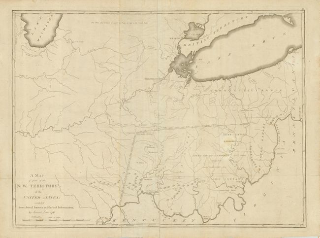
"A Map of part of the N: W: Territory of the United States: compiled from Actual Surveys, and the best Information", Lewis, Samuel

Subject: United States - Midwest

Period: 1796 (dated)

Publication:

Color: Black & White

Size:
25.5 x 18.8 inches
64.8 x 47.8 cm
Download High Resolution Image
(or just click on image to launch the Zoom viewer)

This scarce map covers the region of the Northwest Territory from the southern tip of Lake Michigan, east to include most of Lake Erie, and south to Louisville and the Ohio River. Of particular note are the Revolutionary War Bounty Land Grants shown in the region; the Fire Lands (here Connecticut Lands), the Seven Ranges, and several land grants. In present-day Ohio are Army Lands, Siota Grant to Sargent and others, Symmes, Virginia Line, and Ohio Company. This map was issued shortly after the Treaty of Greenville in 1795, in which the Northwest Indian Confederation ceded to the United States most of Ohio and parts of Indiana, Illinois and Michigan, including plots of land that were to become Chicago (here spelled Chickago), Ft. Defiance, Ft. Wayne and other prominent cities. The map locates many early forts and settlements including Ft. Hamilton, Ft. Washington or Cincinnati, Detroit, Ft. Joseph, Ft. Ouiatanon, Greenville, Ft. Jefferson, Ft. St. Clair, Ft. Adams, Loramier's Store, and an area northeast of Kentucky noted as To the French 24,000 A[cres]. Lewis' map was initially separately issued and then appeared in some copies of Carey's atlases published in 1796, 1802 and 1814. It does not appear in all editions of Carey's atlases and is therefore scarce. Printed on two joined sheets.

References: Phillips (A) #3535-47; Wheat & Brun #678.

Condition: B

There is some light surface soil, and faint stains, minor creases and a small repair on the fold intersection (near Symmes).

Estimate: $3,500 - $4,500

Sold for: $3,000

Closed on 5/9/2007

Archived