Catalog Archive
Auction 119, Lot 18

"Mappe-Monde ou Carte Generale du Globe Terrestre Representee en deux Plan-Hemispheres…", Luyts, Jans
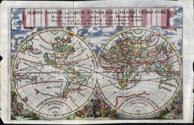
Subject: World

Period: 1699 (published)

Publication:

Color: Hand Color

Size:
12.2 x 8 inches
31 x 20.3 cm
Download High Resolution Image
(or just click on image to launch the Zoom viewer)

This double hemisphere map is beautifully decorated with clouds at the top and allegorical representations at the bottom. The title in the decorative, ribbon banner attributes Nicholas Sanson as the map's originator. It was engraved by Antoine de Winter and first published in Jan Luyts' Introductio Ad Geographiam in 1692. California is shown as an island, and Terre de Iesso stretches between Asia and North America. There is a bit of the coastline of New Zealand nearly connecting to a massiveTerre Magellanique, and Australia, here called Nouvelle Hollande, is only partly mapped.

References: Shirley #553.

Condition: A

With folds as issued. Couple of marginal chips, else fine.

Estimate: $800 - $1,200

Sold for: $600

Closed on 5/9/2007

Archived