"[Lot of 2] Pais Cedes, Sheet Ist containing the Coast of Louisiana and Florida [and] Pais Cedes, Sheet II d. containing the Peninsula & Gulf of Florida, with the Bahama Islands", Jefferys, Thomas
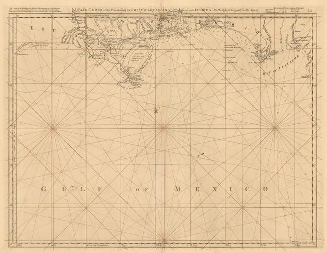
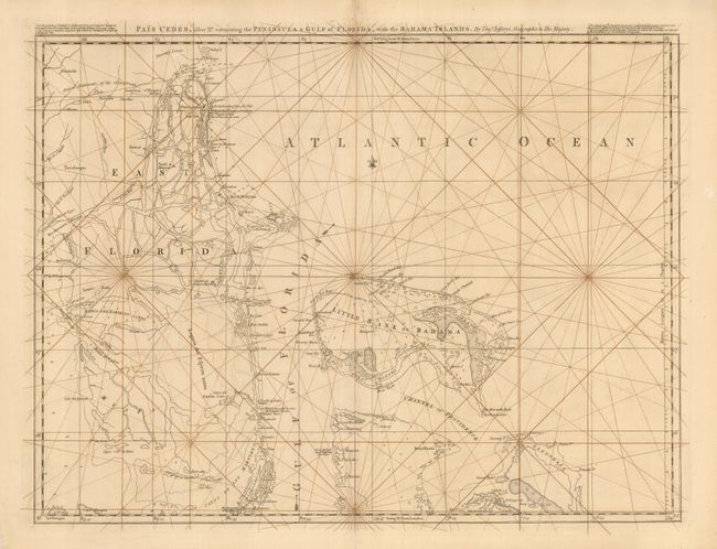
This rare pair of charts was the forerunner of Jefferys' 1775 edition titled "The Coast of West Florida and Louisiana" and "The Peninsula and Gulf of Florida…" A cursory comparison of the two editions shows a couple of important differences. The coastline west of the Mississippi Delta is marked "A Flat Coast little known" and the Florida Peninsula is lacking solid coastlines with the interior a mass of interconnected waterways. The maps are traced with manuscript rhumb lines that appear to be contemporary with the issuance of the maps. Not listed in Steven & Tree and we can find no evidence of the charts being on the market in the last 25 years. (The second map has been pictured first)
References: cf Stevens & Tree #26.
Condition: A
Professional repairs on minor fold separations, else near fine.