Catalog Archive
Auction 119, Lot 164

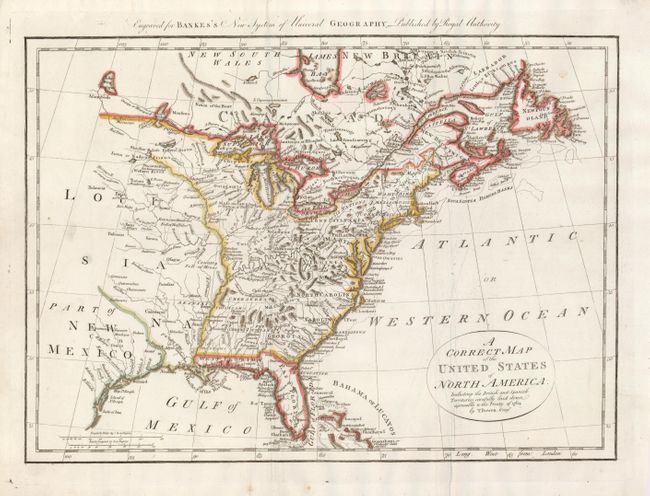
"A Correct Map of the United States of North America, Including the British and Spanish Territories, carefully laid down agreeable to the Treaty of 1784", Bowen, Thomas

Subject: Colonial United States

Period: 1785 (circa)

Publication: Banke's New System of Universal Geography, Published by Royal Authority

Color: Hand Color

Size:
17.4 x 12.1 inches
44.2 x 30.7 cm
Download High Resolution Image
(or just click on image to launch the Zoom viewer)

An early map of the United States created at the conclusion of the American Revolution, after the Treaty of Paris. The western boundary is along the Mississippi River. The western region is full of information up to Lake Winnipeg, with Indian names and interesting notations such as Extensive Meadows Full of Buffalos, north of the Missouri River, and Country Full of Mines, just north of Arkansas.

References: McCorkle #787.1; Sellers & Van Ee #756.

Condition: B

Map with some creasing throughout and some chipping at paper edges, well away from map.

Estimate: $325 - $400

Sold for: $350

Closed on 5/9/2007

Archived