Catalog Archive
Auction 118, Lot 436

"[Lot of 2] Plan de la Rade et Ville de la Vera-Cruz... [together with] De Reede en Haven van Vera Cruz.", Bellin, Jacques Nicolas
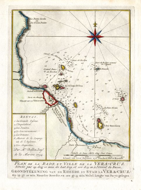
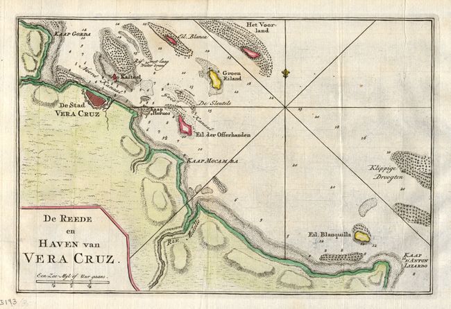
Subject: Mexico

Period: 1754-1766 (circa)

Publication:

Color: Hand Color

Size:
See Description
Download High Resolution Image
(or just click on image to launch the Zoom viewer)

Very nice pair of 18th century maps of the fortified city of Vera Cruz. The first piece is an attractive map of the city of Vera Cruz and surroundings, including Fort San Juan de Ulua. A numbered key at the left notes important buildings, including one for the Inquisition. The map is adorned with a striking compass rose and a distance scale. This was published in 1754 (6x 7.7)". The second map is a striking, small chart of the east coast of Mexico between Vera Cruz and Punta Anton Lizardo. This is the vicinity of the site of the future battle in the war with Mexico that opened the way for the assault on Mexico City. The map shows the city's fortifications and the location of the formidable castle St. Juan de Ulua. This map was made circa 1766 (10.3 x 6.8)".

References:

Condition: A+

Estimate: $200 - $250

Sold for: $150

Closed on 3/6/2007

Archived