Catalog Archive
Auction 118, Lot 336
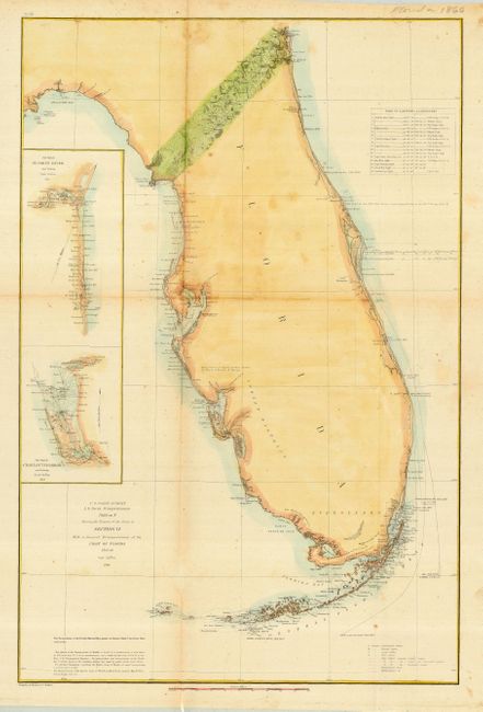
"U.S. Coast Survey A. D. Bache Superintendent Sketch F Showing the Progess of the Survey in Section VI With a General Reconnoissance of the Coast of Florida 1848-60", Bache, Alex D.
Subject: Florida
Period: 1860 (dated)
Publication: United States Coast Survey
Color: Hand Color
Size:
16.5 x 25 inches
41.9 x 63.5 cm
Download High Resolution Image
(or just click on image to launch the Zoom viewer)
(or just click on image to launch the Zoom viewer)