Catalog Archive
Auction 118, Lot 274

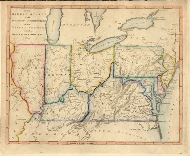
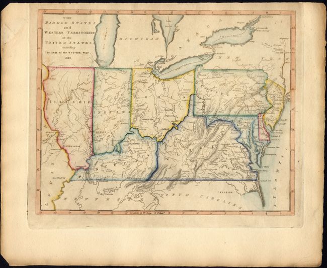
"The Middle States and Western Territories of the United States including the Seat of the Western War", Carey, Mathew

Subject: United States - Midwest and Mid-Atlantic

Period: 1812 (dated)

Publication:

Color: Hand Color

Size:
9.7 x 7.7 inches
24.6 x 19.6 cm
Download High Resolution Image
(or just click on image to launch the Zoom viewer)

Mathew Carey was a seminal figure in early American publishing; establishing the first publishing firm to specialize in cartography and issuing the first atlas devoted exclusively to American maps. He set up an elaborate cottage system of craftsmen for compiling, engraving, printing, and coloring maps. This practice was emulated by later American cartographic publishers such as John Melish and Henry S. Tanner. The American Atlas concept was also adopted by other publishers in both the United States and Europe.

This copper engraved map covers the region from New Jersey to Illinois and names Indiana, Kentucky, Virginia, Ohio, Pennsylvania, Maryland, and Delaware. The northern borders of Illinois and Indiana are aligned with Ohio, so they are beneath Lake Michigan. Chicago is correctly on the lake, but is in the unnamed region west of Lake Michigan. Michigan is named and Detroit is located. The map was obviously made to show the region involved in the War of 1812 with the British.

References:

Condition: A

The plate is printed off center favoring the top of the paper and leaving a narrow upper margin. Nice original hand coloring on thick paper with original margins. A little browning at right margin.

Estimate: $300 - $350

Sold for: $375

Closed on 3/6/2007

Archived