Catalog Archive
Auction 118, Lot 271

"Carte des Etats-Unis Provinces Meridionales", Rochefoucald Liancourt, Francois Alexander

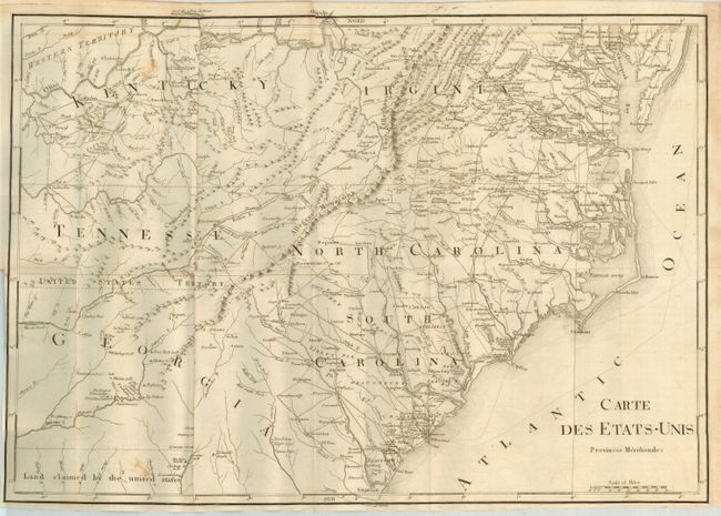
Subject: Southeast United States

Period: 1799 (circa)

Publication: Voyage dans les Etats-Unis… (Travels through the United States)

Color: Black & White

Size:
20.5 x 14.5 inches
52.1 x 36.8 cm
Download High Resolution Image
(or just click on image to launch the Zoom viewer)

French edition of this interesting map that covers all of the Carolinas with parts of Virginia, Kentucky, Tennessee and Georgia. The entire map is in English with only the title in French. It provides great detail of early roads and settlements. Between Tennessee and Georgia is a long strip of land labeled United States Territory. This land originally belonged to South Carolina but was ceded back to the United States in 1787. Numerous Indian villages are shown, especially in the region of present-day Alabama. Below Georgia is Land claimed by the United States referring to the disputed region between the United States and Spain. The English edition, titled "Map of the Southern Provinces of the United States," was engraved by J.C. Russell and published by R. Phillips, but this edition carries no such attribution.

References: cf Phillips (M) p. 873

Condition: B

Folding as issued. Near fine example with a couple foxing marks at upper left and light line of offsetting across top.

Estimate: $400 - $500

Sold for: $325

Closed on 3/6/2007

Archived