Catalog Archive
Auction 118, Lot 249

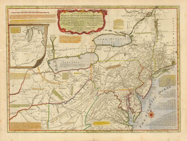
"A general Map of the Middle British Colonies in America: Viz. Virginia, Maryland, Delaware, Pensilvania, New Jersey, New York…", Jefferys/Sayer

Subject: Colonial Mid Atlantic and Great Lakes

Period: 1775 (dated)

Publication:

Color: Hand Color

Size:
26 x 19 inches
66 x 48.3 cm
Download High Resolution Image
(or just click on image to launch the Zoom viewer)

This is the fifth state of Thomas Jefferys' derivative of the seminal Lewis Evans map of the Middle British colonies, which is one of the landmarks of American cartography. It illustrates the region from Montreal and the lower end of Lake Huron to the North Carolina border, and from the Falls of the Ohio to Narragansett Bay, with an inset of Welinis or Illinois. Evans' map contributed enormously to the cartographic knowledge of the Ohio Valley, the region that was at the center of friction between England and France during the French and Indian War. Jefferys' edition improved on Evans' map by depicting the British and French forts in the area of the Ohio River. It also contains several additional important notations including descriptions of the lands claimed by the different Indian tribes, especially the Confederate Nations. Imprint at bottom right: Sold by R. Sayer in Fleet Street & T. Jefferys, Charing Cross. Price 2s:6d. Publish'd as the Act directs 15 June 1775.

References: McCorkle 775.5; Steven & Tree #30-e.

Condition: B

Some light scattered foxing. Some minor tears in blank margins.

Estimate: $3,000 - $4,000

Sold for: $2,750

Closed on 3/6/2007

Archived