Catalog Archive
Auction 118, Lot 109

"Recentissima Novi Orbis Sive Americae Septentrionalis et Meridionalis Tabula", Danckerts, Justus

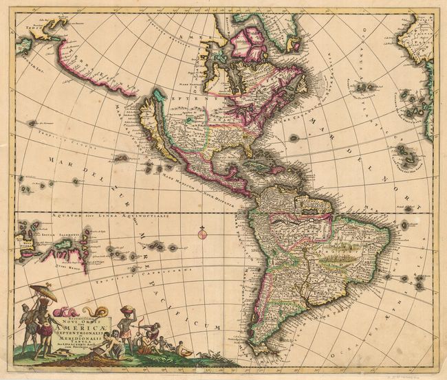
Subject: Western Hemisphere

Period: 1696 (circa)

Publication:

Color: Hand Color

Size:
22.8 x 19.3 inches
57.9 x 49 cm
Download High Resolution Image
(or just click on image to launch the Zoom viewer)

Uncommon, first state of this beautiful map of the Americas and an interesting version in this series of maps inspired by Nicolas Visscher in 1658. Danckerts' map follows Sanson's geography for the interior of North America with open-ended Great Lakes, the island of California, and the R. del Norte being a confusion between the Rio Grande (with Santa Fe located near its source) and the Colorado River (emptying into the Gulf of California). Added above California is a huge Terra Esonis stretching nearly to Japan, a bit of which is visible in the upper left border. There are dozens of place names along this spurious coastline. The cartography of South America is derived from De Wit and depicts the northern region overly wide. De Wit's tribal vignettes fill the interior of Brazil and Parime Lac appears on the Equator. One of the most interesting features of the map is the early appearance of Quiri Regio in the South Pacific, reflecting early Dutch exploration in the vicinity of Australia. The bottom title cartouche was copied from De Wit.

References: McLaughlin #123; Tooley (Amer) p. 124, #53.

Condition: B

Lovely impression and original color. Professional paper replacement and repairs at the bottom of the map. Some flaws in bottom border and a small amount of facsimile on neatline and a little bit in cartouche. Couple of spots of foxing in map.

Estimate: $1,800 - $2,200

Sold for: $1,300

Closed on 3/6/2007

Archived